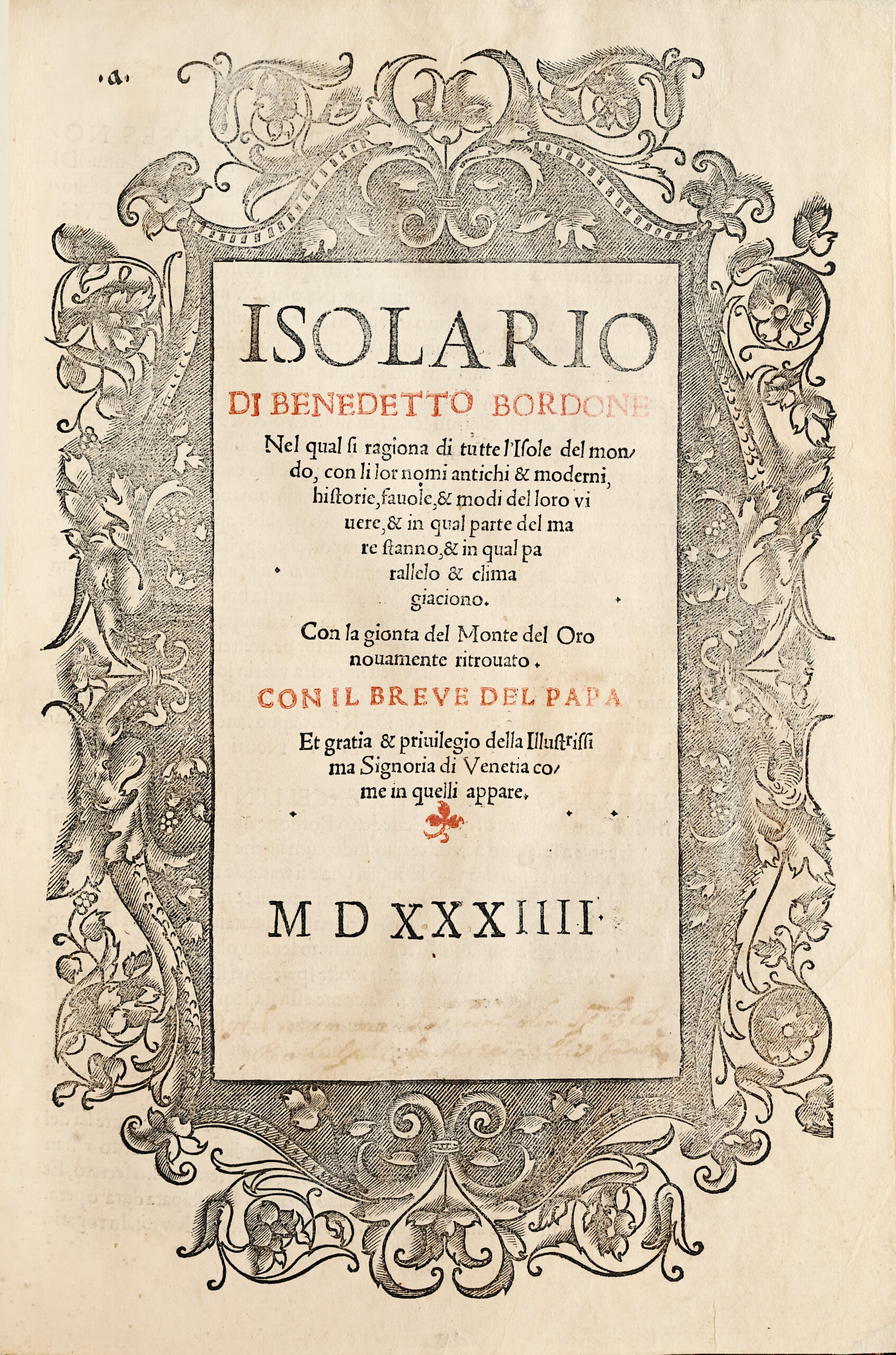
Venice, Nicolo d’Aristotile Zoppino, June 1534.
Folio [297 x 203 mm] of (4) ll. including a title printed in red and black within an ornamental border, 74 ll. presenting 112 wood engraved maps, of which 4 on double-page (3 mounted on tabs) and 2 full-page, one diagram, ornamented and historiated initials, lower white margin of final leaf and l. 66 restored without loss of text, contemporary marginalia throughout. Full light-brown Jansenist morocco. Modern binding.
The rare second and, from an Americanist point of view, the most desirable edition of the « Isolario » as it contains for the first time the « Gionta del Monte del Oro novamente ritrovato » mentioned on the title-page, the earliest authentic description of Pizzaro’s entry into Peru to appear in a printed book.
Phillips/Le Gear 163 ; Nordenskiöld Coll. 28 ; Sabin 6419 ; Alden / L. 534/2 ; Borba de Moraes, I, 112 Anm. ; Index Aurel 122-344.
First edition to use the term “isolario” on the title.
The isolario, or « book of islands », was a cartographie form introduced and developed in Italy during the fifteenth and sixteenth centuries. Like the portolan, or pilot-book, to which it was related, it had its origin in the Mediterranean as an illustrated guide for travelers in the Aegean archipelago and the Levant.
Bordone’s ‘Isolario’ was the second isolario to be printed and the first to give prominence to the transatlantic discoveries.
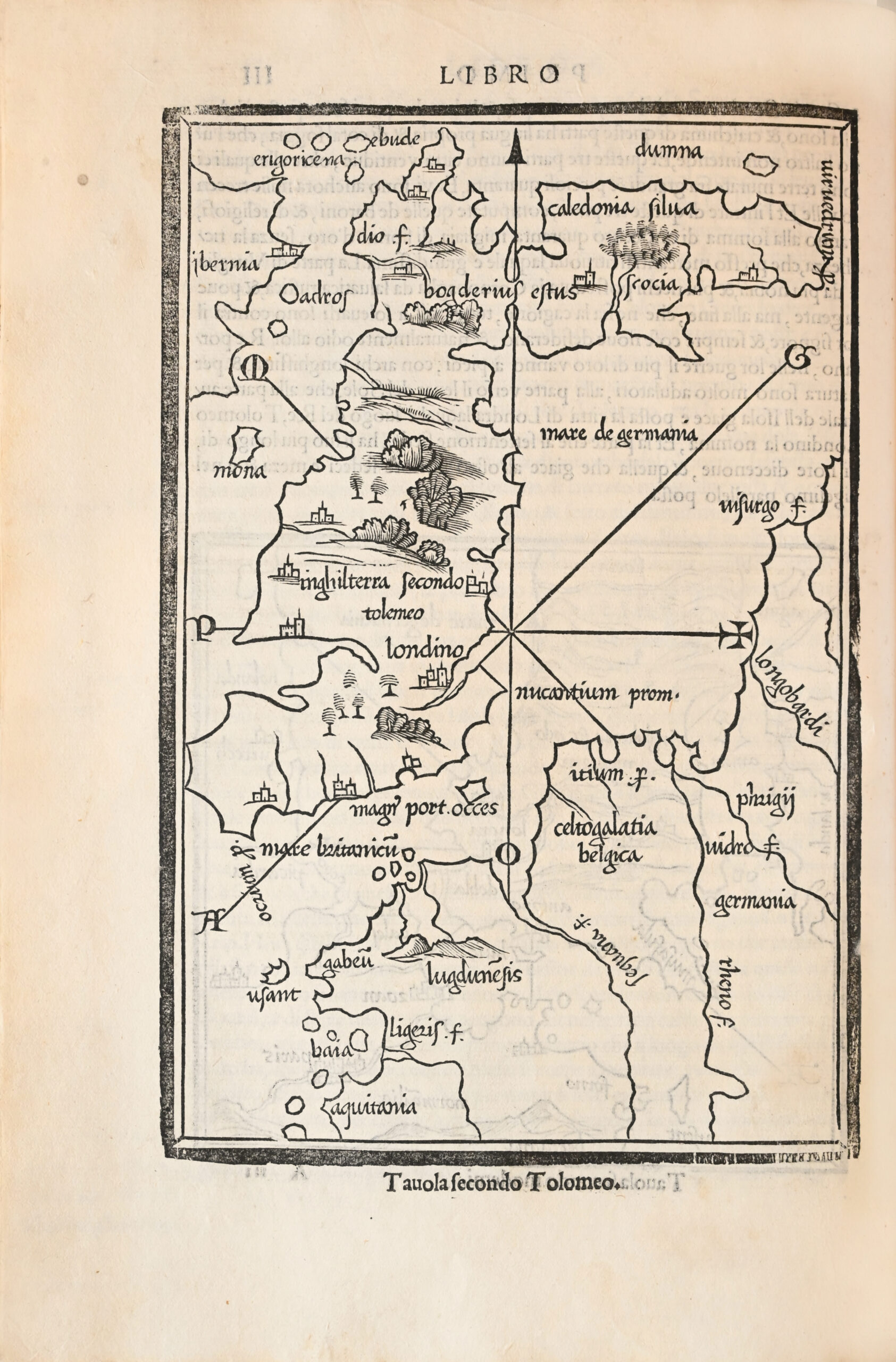
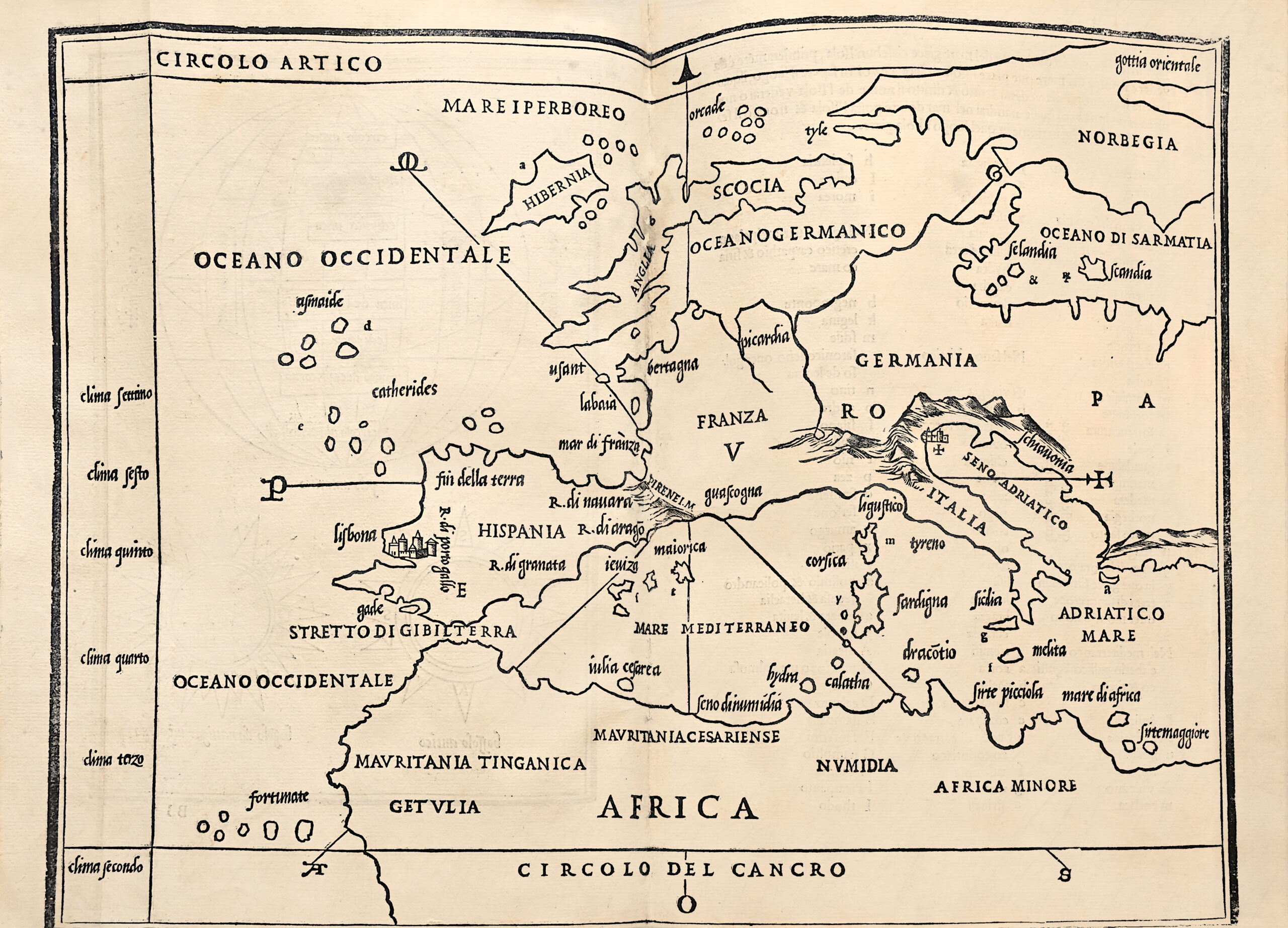
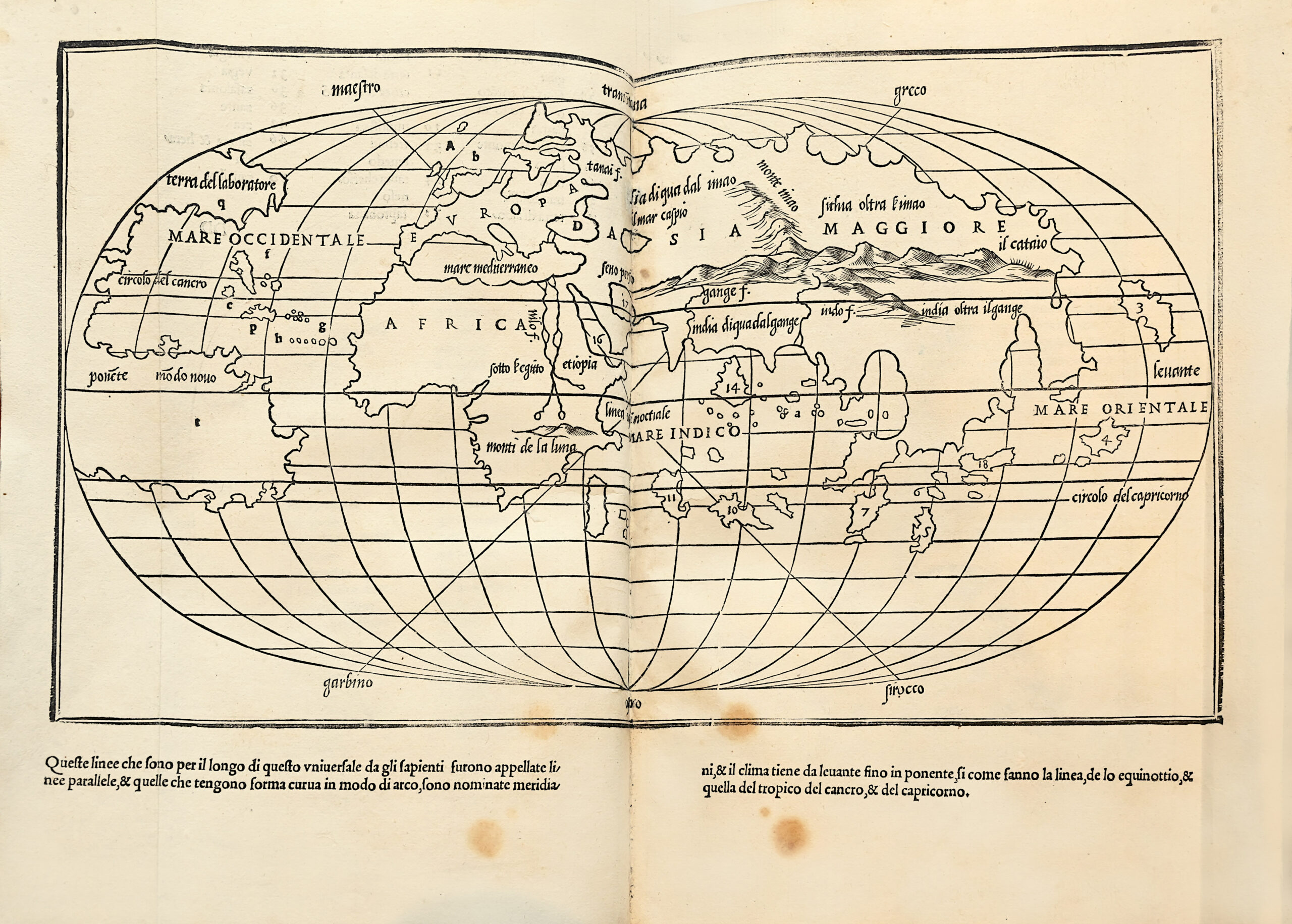
Divided into three books, the « Isolario » is devoted, respectively, to the islands and peninsula of the Western Ocean, to the Mediterranean, and to islands of the Indian Ocean and the Far East. While this order corresponds very roughly to that of Ptolemy, it gives conspicuous priority to the discoveries across the Atlantic. In addition to a page of diagrams illustrating the construction of a circular world map and wind roses of “ancient” and “modem type”, there are three general maps: Europe, the Aegean, and an oval world map. The work also contains 107 small maps, plans, or views, including a nearly three-quarter page plan of Mexico City before the conquest of Cortez – which qualifies because it is an island. According to Cortazzi, the ‘Isolario’ also contains the earliest European printed individual map of Japan.
It contains early depictions of the Carribean islands Cuba, Jamaica and Hispagnola, as well as a large birds eye view of Venice. It also contains on the last two leaves the first printed account of Pizarro’s conquest of Peru in 1533.
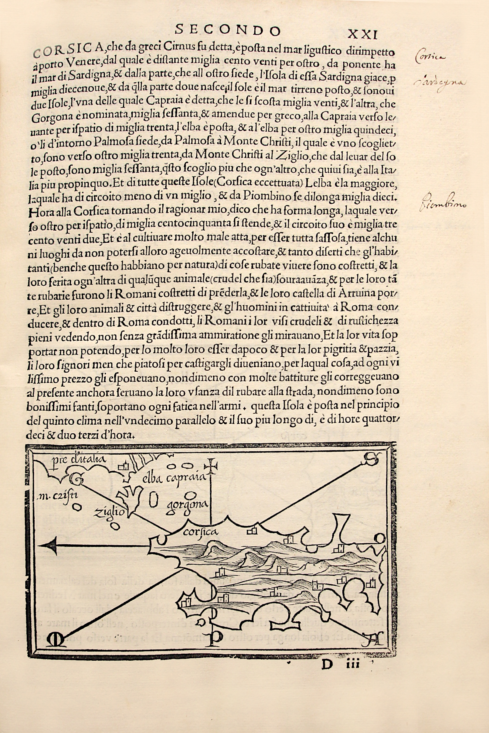
This edition also contains the first printed map of Corsica.
Very rare and first printed map of Corsica, published in the second edition of the Isolario by Benedetto Bordone. The island is shown horizontally, with the north facing left. The map is derived from Andréa Bianco’s portolan of 1436, and only bears the name “Corsica”, located at the Cape of Corsica. Eleven towns are represented by drawings of castles. To the north-east of the island, the islands of Elba, Capraia, Giglio and Montecristo can be seen. On the verso is a map of Pianosa, here called Palmosa, the north of Corsica with the named Cape Corsica, the south of Elba and the islands of Capraia and Gorgona.
Text in Italian on both pages.
A miniaturist, geographer and engraver from Padua, Benedetto Bordone worked in Venice. His Isolario made him famous.
A precious copy of this most rare and sought-after isolario.