FERRARIS, Joseph Jean comte de. Carte Chorographique des Pays-Bas Autrichiens Dédiée à leurs Majestés Impériales et Royales… gravée par L.A. Dupuis. N. p., 1777.
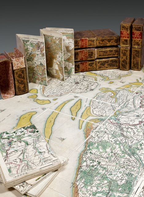
Engraved map divided into 25 large numbered plates of varied dimensions composed in total of 450 small boards cut and assembled of about 20 x 13 cm each. The set of 25 plates is mounted on cloth with the number of the plate handwritten in ink at the back of the cloth. Most of the plates have been handcolored at the time. Plates I, XI, XVII, XIX and XXI are only partly colored. The set is preserved in 6 cases of marbled calf decorated with gilt borders, red morocco lettering pieces on the spine of the cases. Contemporary cases.
Total dimensions of the map with the plates put end to end: around 400 x 280 cm. Dimensions of each case: 205 x 145 mm.
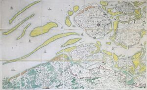
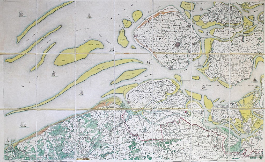
Very large precious military map (scale 1:86400) of the Austrian Netherlands depicting what corresponds today to Belgium, Luxemburg, a part of the German and Dutch lands and north of France.
From 1741, the general governor of the Austrian Netherlands, Charles-Alexandre de Lorraine, wants to defend the interests of the Netherlands. He simultaneously encourages the progress of the Enlightenment and the economical development, sponsoring initiatives such as the creation of the Brussels Teresian Academy (1772), the realization by Count Joseph de Ferraris of a very precise map of the territory (1770-1778), or various technical and industrial experiences in his castle of Tervuren.
Ferraris’ map or “map of the Austrian Netherlands” is a historical map made between 1770 and 1778 by the count Joseph de Ferraris, director of the mathematical school of the Netherlands artillery corps, with the support of governor Charles de Lorraine. It is the first methodical and large-scale cartography, as well in “Belgium” as in the entire western Europe.
The count de Ferraris made himself known with this map published on his initiative in 1777, where all the Austrian Netherlands are listed to the smallest detail. This is the first topographic map of Belgium based on a land survey made under the administration of the Emperor Joseph II and of the Empress Maria Theresa. The work of topographical survey started in 1771 and was made on the current Belgian and Luxembourg territory as well as on part of the German and Dutch territories. It was made by students of the Mathematical School of the Netherlands Artillery Corps.
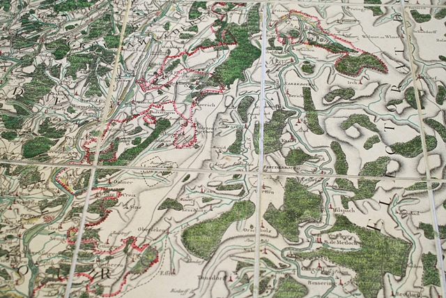
Entirely hand-made and hand-drawn by the officer cadets, Ferraris’ map had an exclusively military purpose: it listed the most important strategic element such as rivers, bridges or sunken lanes where troops could hide.
In 7 years, the work was achieved, the result being a huge handwritten map on a scale of I:11250, the “Cabinet Map”. Between 1773 and 1777 a team of French engravers composed of L.A. Dupuis, Patas and B.A. Nicollet worked to achieve the engraved version of this map.
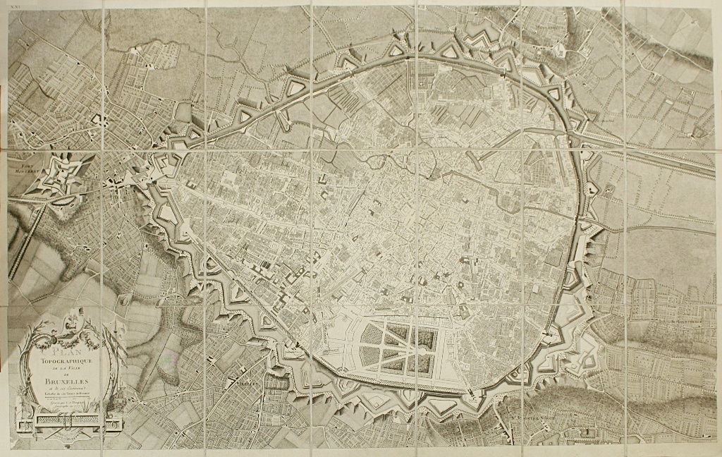
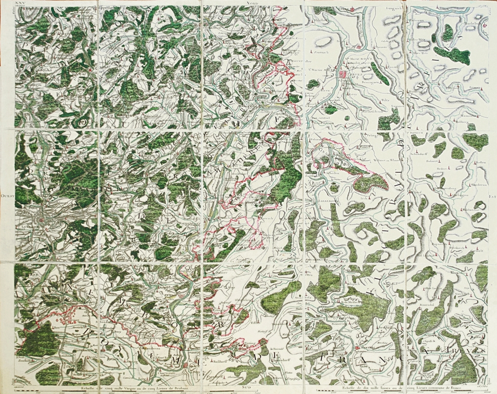
Thus, they published in 1777, on a scale of 1: 86400, this superb map with many details, which counts 450 small boards divided up among 25 boards. Among the 25 boards, the map encloses an explanation (board I), a title in an elaborated cartouche (board XI), a nice view displaying the presentation of the map to the Emperor Joseph II (board XVI), a map of Brussels (board XXI), a general map (board XXII) and an index (board XXIII). Most of the small boards have also been superbly hand-colored at the time.
Lacking of any reference system, the map informs about the relief, the land use, the habitat, the road and hydrographic network, the parish organization as well as the administrative limits at the time. Besides, many enclaves are visible. Some of them, belonging to the French territory in 1770, have only been partly charted.
This map, made for military use, is however the testimony of a territory since then transformed by industrialization.
Superb set in perfect condition.