


N.p., 1739.
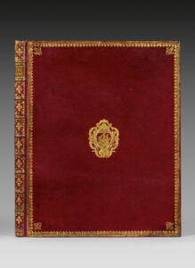
Folio [558 x 443 mm] bound in red morocco, covers decorated with fleur-de-lys borders, fleurs-de-lys in the corners, coat of arms in the center, spine ribbed and decorated with fleur-de-lys of various sizes, stars and gilt fillets, inner border decorated with fleurs-de-lys, gilt edges. Contemporary binding.
First issue of the most famous antique map of Paris, called « plan de Turgot ».
James de Rothschild. 2312; Cohen 807.
It is composed of one plan of combination and of 20 engraved plates on double-page (800 x 515 mm) representing the capital, house by house, in a panoramic view. « We propose by making this engraved map to show at a glance all the buildings and all the streets of Paris » informed the editor.
“This bird’s eye map, the widest of this sort ever tackled, is known under the improper designation of ‘Plan de Turgot’. It is composed (besides the map of combination) of twenty leaves that, altogether, form five ranks. Each leave as a surround of 79 centim. large on 50 high. The twenty assembled leaves thus form a square of about 316 centim. on 245, excluding the margin. This surface would bother more than one Parisian amateur, whose allocation is way too narrow to have it in its cabinet.
The engraved title is at the bottom of the leaves 18 and 19, in the middle of a cartouche with a very circumvented shape, surrounded with volutes and topped with the allegorical figure of the city of Paris resting on her shield.
This map takes usually the form of a large folio atlas; each leaf, printed on thick paper, is folded in two and glued on guard. It is said that most copies were bound at the time with more or less luxury, to be distributed for free, with no doubt, to distinguished figures; all sheepskin or Levant morocco bindings are decorated in their center with the arms of Paris. Some copies were printed with wide margins..
This map ends the series of bird’s eye maps, and if, after this period, we still see some of those published, it would be older maps, copied or refreshed. Louis Bretez, who drew it around 1734, derogated the generally admitted custom of positioning maps according to the noon mark, because, willing to give of Paris an image in front view, he had to prefer, with the model of previous geographers, a system that would allow to see in front view the gates of our ancient churches, so numerous still, churches that, for the most part, had their facades directed westward. It is deplorable that the map, as it was conceived, wasn’t created on an earlier date at least from a century. It would have been, because of its dimensions, of a much higher interest for the archaeologists of today.
The drawing ordered by Turgot was achieved in 1734; it represents thus the state of Paris at this time. Claude Lucas, who engraved it, is probably the one who worked on the maps of the districts of La Caille, 1714, or perhaps his son.
The choice that was made of a bird’s eye map must have led to huge costs…
The image of Paris represented here still offers, I say it again, a big appeal and documentation for archaeology. The few number of ancient buildings that have survived is so quickly diminishing, day by day, or is suffering from strange metamorphoses with the hideous mask of replastering, so much that the Paris of Turgot, threatened by our thousands of projects of alignment and expansion, will soon have to be called, in turn, the ‘old Paris’ […]. (A. Bonnardot, Etudes archéologiques sur les anciens plans de Paris, pp. 199-203).
These plates, remarkably engraved, show in a vivid way the former layout, in perspective, of the Parisian sites, residences and monuments.
Copy printed on thick paper, illustrated with brilliant proofs, preserved in a binding by Padeloup with the arms of Paris.
The title is engraved in the center of a blending of two plates. (1600 x 540 mm).
