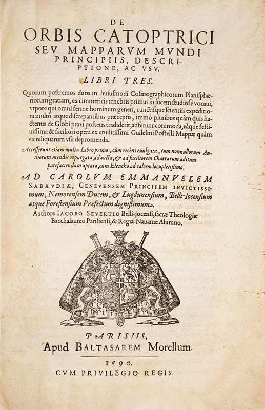
Paris, Baltasar Morel, 1590.
Folio [318 x 210 mm] of (6) ll., 232 pp. numbered 332, (7) ll., some slight foxing and light waterstains. Granite-like calf, spine ribbed, mottled edges. Contemporary binding.
Extremely rare first edition of this precious work of astronomy and navigation using the fundamental discoveries of Copernicus, Schöner and Nonius in order to develop these same astronomical knowledge and to establish new cosmographical and geographical data by means of new map surveys with projection, mathematical tables and diagrams of the earth.
The work is dedicated to Charles Emmanuel duke of Savoy, the sovereign of Jaques Severt’s native town. The 12-page prologue is of a particular interest for the progress of knowledge concerning America: are mentioned: Amerigo Vespucci (“qui anno 1497 Americam de suo nomine appellatum aperuit”); Magellan (“Australior terra, seu nova Guinea, a posteris reperta est, ad cuius fretum Magellanus transitum primus reperit”); Christopher Colombus “qui anno 1492 Americam feri totam traiecit ; Francis Drake is also highly esteemed for his qualities of scientific explorer.
The first two books are dedicated to a detailed exposition of the astronomical techniques used by the main scholars of the 16th century, such as Pierre Apian, Oronce Fine, Jacopo Gastaldi, Vopellius, Michel Coignet, Pierre de Medina, Sebastian Munster, Gerard Mercator, Abraham Ortelius, Gemma Frisius… Severt gives us an encyclopedia of the geographical and astronomical knowledge of that time, drawing his inspiration from works by Schöner, Nonius and Copernicus.
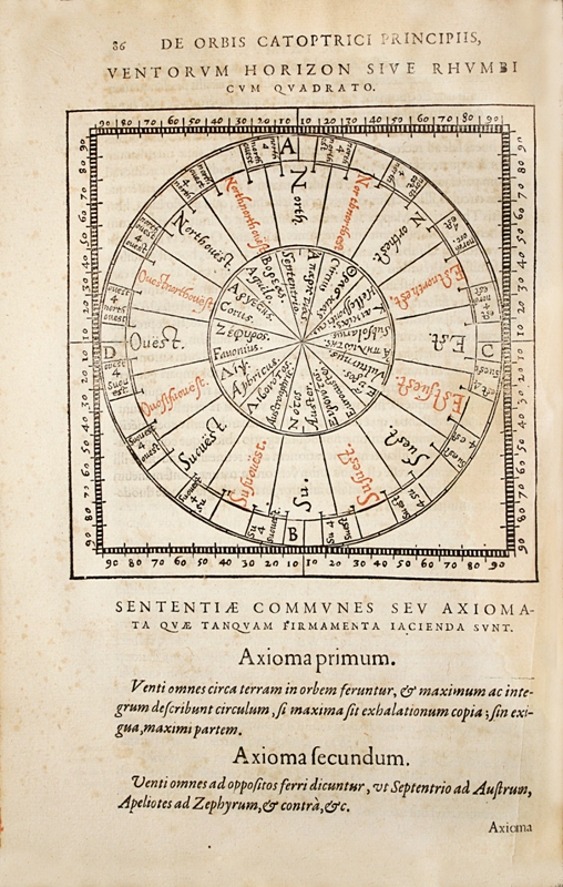
In the first book the attention is turned to the help given to navigation by astronomical surveys. A very detailed compass card (page 86) defines the positions in terms of degrees of longitude and latitude and uses the English expressions “North-west” “North-northwest”
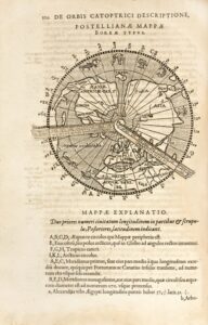
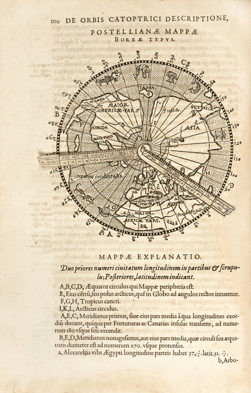
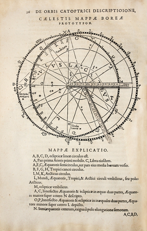
In the second book a detailed exposition resumes the technical projection for celestial and terrestrial maps, by Guillaume Postel (page 102) a colleague of Severt at the University of Paris, by André Thevet, by Gastaldi, Gemma Frisius (pages 104-105) and Mercator (pages 106-107).
The celestial and terrestrial maps of Postel are represented in woodcuts (page 96 – page 100), the first one bearing an insert with movable part and French captions, the second one representing the entire earth, seen from the North Pole, including the North of America with “Florida”, “Nova Francia” and “Mexico”. Leo Bagrow in “Ortelius Catalogus Cartographorum”, 1928, pages 31 and 76, volume II, page 86, pointed out Severt’s descriptions of maps with projections by Gastaldi, Frisius and Thevet, describing them as “extremely well informed”.
The third book is a kind of recap of the techniques of cartography described and a practical application, based on the various progresses brought in the reading processes and recording of cosmographical and astronomical observations.
Postel’s « Planisphere » is represented in a woodcut (page 148); besides the author gives us many valuable information including the tables of “climates”.
Thus the illustration is composed of 13 woodcuts of which 2 with movable parts, including a world map, a compass card printed in red and black, and numerous diagrams representing planispheres with projections, by Guillaume Postel, André Thevet, Jacopo Gastaldi, Gemma Frisius and Gerard Mercator. Illuminated initial-letters, including one representing a scholar at work, adorn the text.
This scientific book of the 16th century is so rare (this copy is the only one to appear on the international market for more than 30 years) that it is unknown to most bibliographers. Neither Brunet knows it nor Deschamps, which is absolutely exceptional for an important French book from the end of the 16th century. The first scholar to understand the importance of this book was Leo Bagrow who in Ortelius Catalogus Cartographorum, published in 1928, pointed out Severt’s exceptional work and in particular his descriptions of maps with projections by Frisius and Thevet. J. Keuning in The history of geographical Map Projection until 1600 in « Imago Mundi » also establishes his reputation.
This copy is the only one to appear on the international market for more than 30 years. Adams lists only one copy of the De orbis Catoptrici “in Cambridge Librairies” Reference S 1020.
References: Leo Bagrow. Ortelius Catalogus Cartographorum, 1928; J. Keuning “The history of geographical Map Projection ” until 1600 in Imago Mundi; Adams. Cambridge Librairies. S1020.