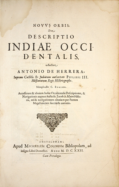
Amsterdam, Michel Colin, 1622.
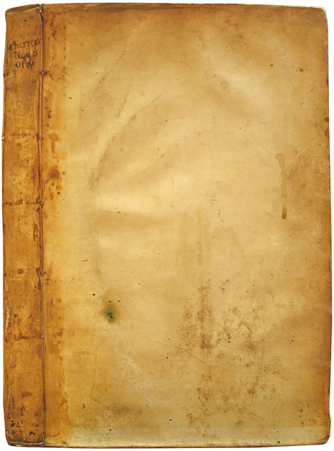
Folio [370 x 250 mm] gathering 6 parts: (6) preliminary ll. including 1 engraved frontispiece, the foreword, and 2 preliminary ll. of the second text bound by mistake at the beginning of the volume; I/ « Herrera’s Indiae Occidentalis » ll. 1 to 44, 14 maps; II/ « Jacob Le Maire’s ‘Historia Navigationis Australis’», (1) l. (the other 2 preliminary ll. are bound by mistake at the beginning of the volume), 1 portrait of Jacob Le Maire, ll. 46 to 74, 3 large maps, figures in the text; III/ « Account of the Spanish expedition to the strait of Magellan… », ll. 74-75; IV/ « Short history of the voyages to the strait of Magellan », ll. 75 to 83; V/ « Description of the West Indies by Ordonez de Cevallos », 10 ll. wrongly numbered 9 ; VI/ « Description of America, from the geographical tables of P. Bertius », 11 ll. Bound in limp contemporary vellum, flat spine with the handwritten title. Contemporary binding.
The first complete account of Le Maire’s world tour, which allowed him to be the first sailor to cross Cape Horn. Huth 684; Brunet, III, 132; Leclerc n°281; Sabin 31540; Borba de Moraes, I, 400.
First Latin edition. Herrera’s account was initially published in Spanish in Madrid in 1601 with only 14 maps. The bookseller Michel Colin then published simultaneously in Amsterdam editions in Latin, French and Dutch in 1622, adding 3 additional maps to the Spanish first one. The 5 parts enclosed in this edition are listed on the verso of the general title-page. The heirs of Theodore de Bry would then reprint Herrera’s work in Frankfurt in 1623 as the twelfth part of their “Great Voyages”, with reduced versions of the plates.
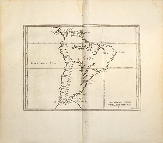
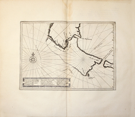
The first and second parts of the work (“Description of the New World by Herrera” and “Journal of the navigation of Le Maire”) deal with the New World and are illustrated with 17 maps of the utmost interest depicting the American continent. The large folding map enclosed in the second part shows the route followed by Le Maire across the Pacific during his travel in search of Terra Australis in 1615-17. Le Maire is an eminent Dutch merchant, competitor to the East India Company. He was granted the privilege to trade in the West Pacific. The chart of the India Company forbids to other Dutch companies to use either the Strait of Magellan or the Cape of Good Hope, the only roads to make trade within the East Indies. Convinced that it is possible to find a new route from the Atlantic to the Pacific, Le Maire succeeds in convincing the merchants of the small town of Hoorn to finance an expedition composed of two ships. He embarked on June 14, 1615, in charge of the Eendracht, with Willem Cornelisz of the Hoorn. Together, they set up a plan for their new company, the goal being to travel in the search of the South Pacific resources mentioned by Quiros. On January 29, 1616, they indeed discovered a route around the southernmost headland of the American continent, which they named “Kaap Hoorn”. They led thus the first expedition to successfully round Cape Horn.
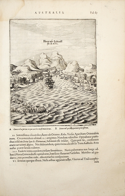
The expedition failed as for the gold discovery, but it allowed tracing a route to the great Austral continent through the Pacific. Besides, in their expedition they discovered the Barnevelt islands, the Tuamotu Archipelago, the Tongas islands, the Horn islands, the north of Melanesia, the northern coast of New Guinea, the Schouten islands, the Moluccas, etc… Le Maire’s was the last of the 17th century expeditions to search for the unknown continent from the east, and it generated many discoveries in the Pacific. Among others it allowed to establish that New Guinea was an isolated island and not the western most edge of the imaginary continent. After having spent two years out at sea, during which Le Maire made many geographical discoveries, he died in Mauritius.
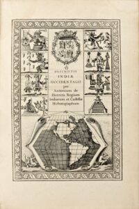
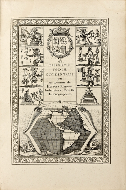
The abundant illustration is composed of a full-page engraved portrait of Jacob Le Maire, of an engraved elaborate frontispiece within foliated woodcut border decorated with the Castilian arms, eight two vignettes of six Aztec gods and Mexican scenes, and includind a cartouche at bottom with image of North and South America, the first map to show California as an island. The work is also adorned with engravings in the text in the section relating Le Maire’s Travel as well as 17 double-page maps of the utmost interest picturing North, Central and South America, as well as the Pacific. The large folding map enclosed in the second part shows the route followed by Le Maire during his travel in search of ‘Terra Australis’ in 1615-17, with details on the Pacific islands groups and New Guinea.
A precious copy, particularly wide-margined, preserved in its original contemporary limp vellum binding.
See less information