
Amsterdam, Henrici Hondij, 1623.
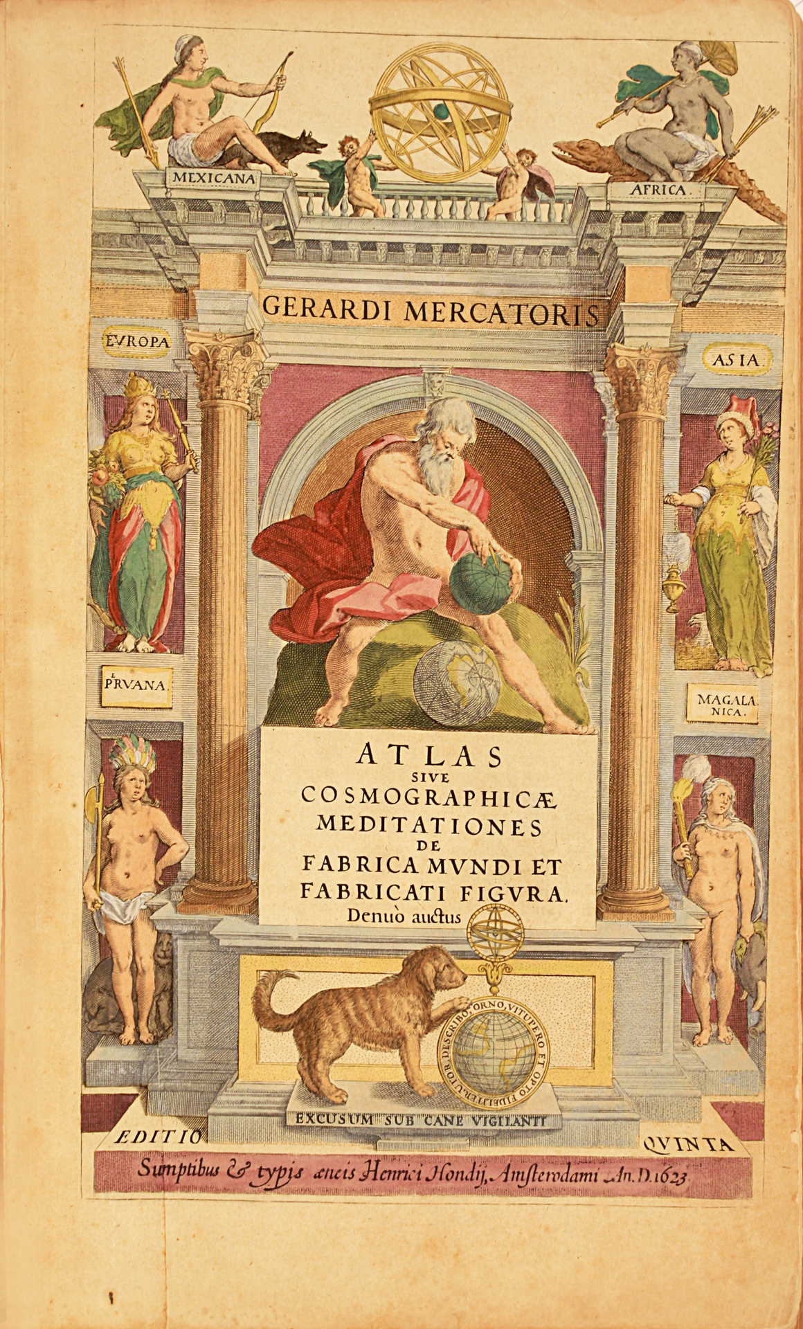
Large folio [450 x 300 mm] of (11) ll. including the engraved title and the double-page plate presenting the portraits of Mercator and Hondius, 374 pp., 18 ll., 156 maps on double-page. Text in Latin. Some foxing. Later brown calf, blind-stamped fillet on the covers, spine ribbed.
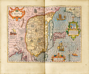
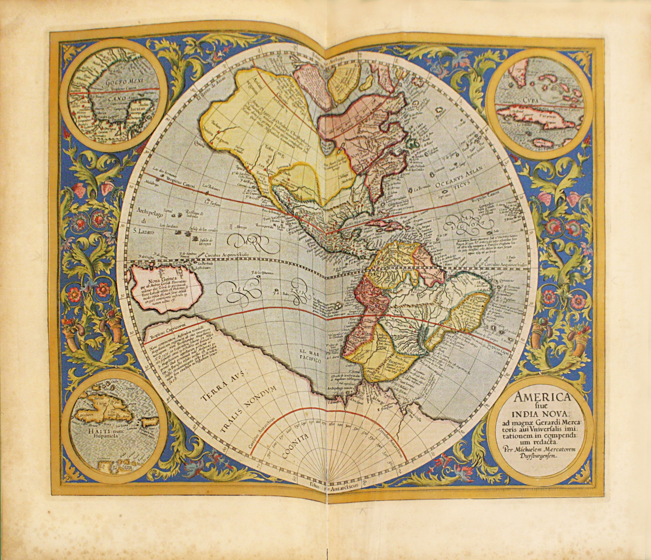
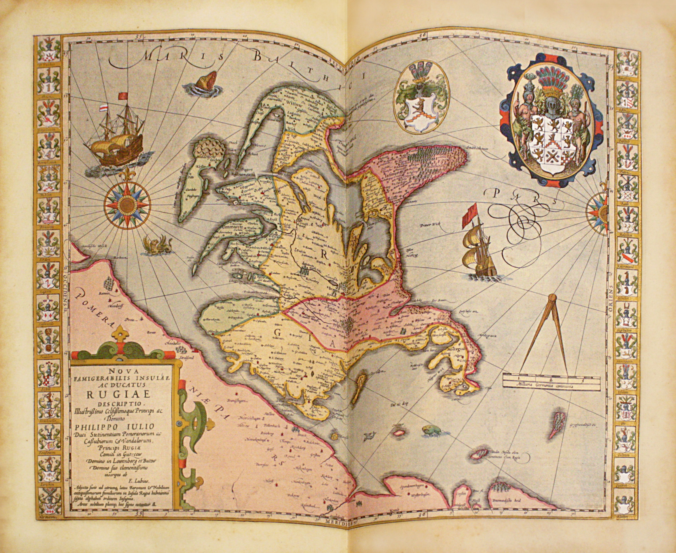
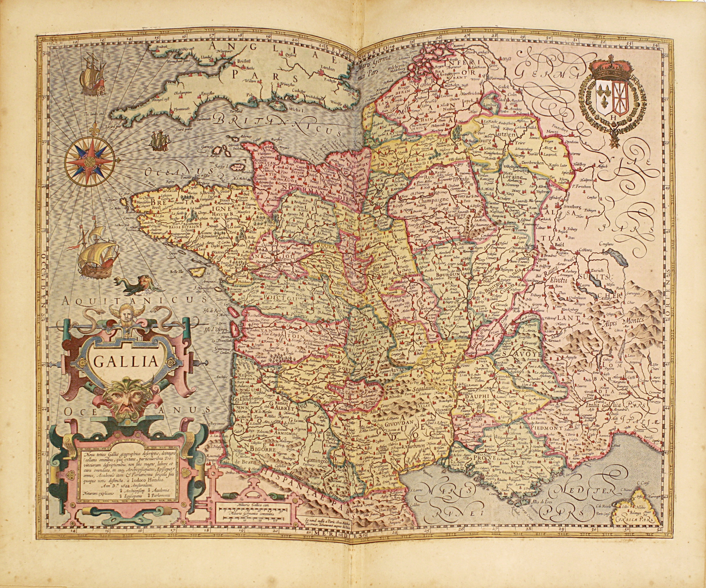
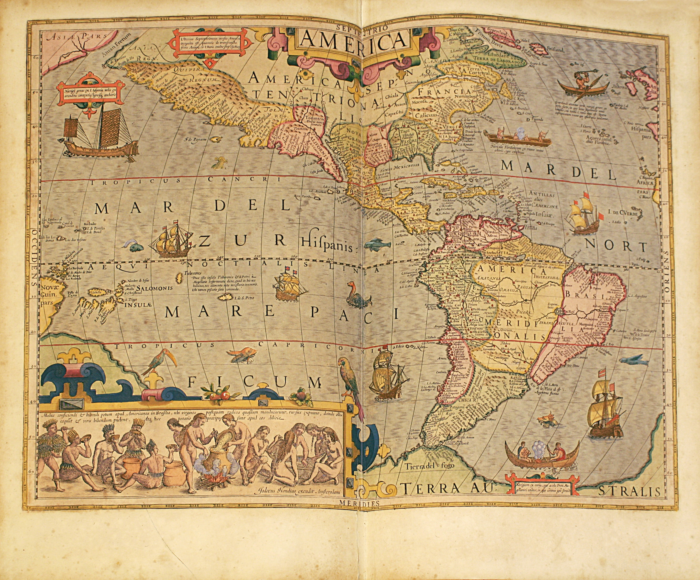
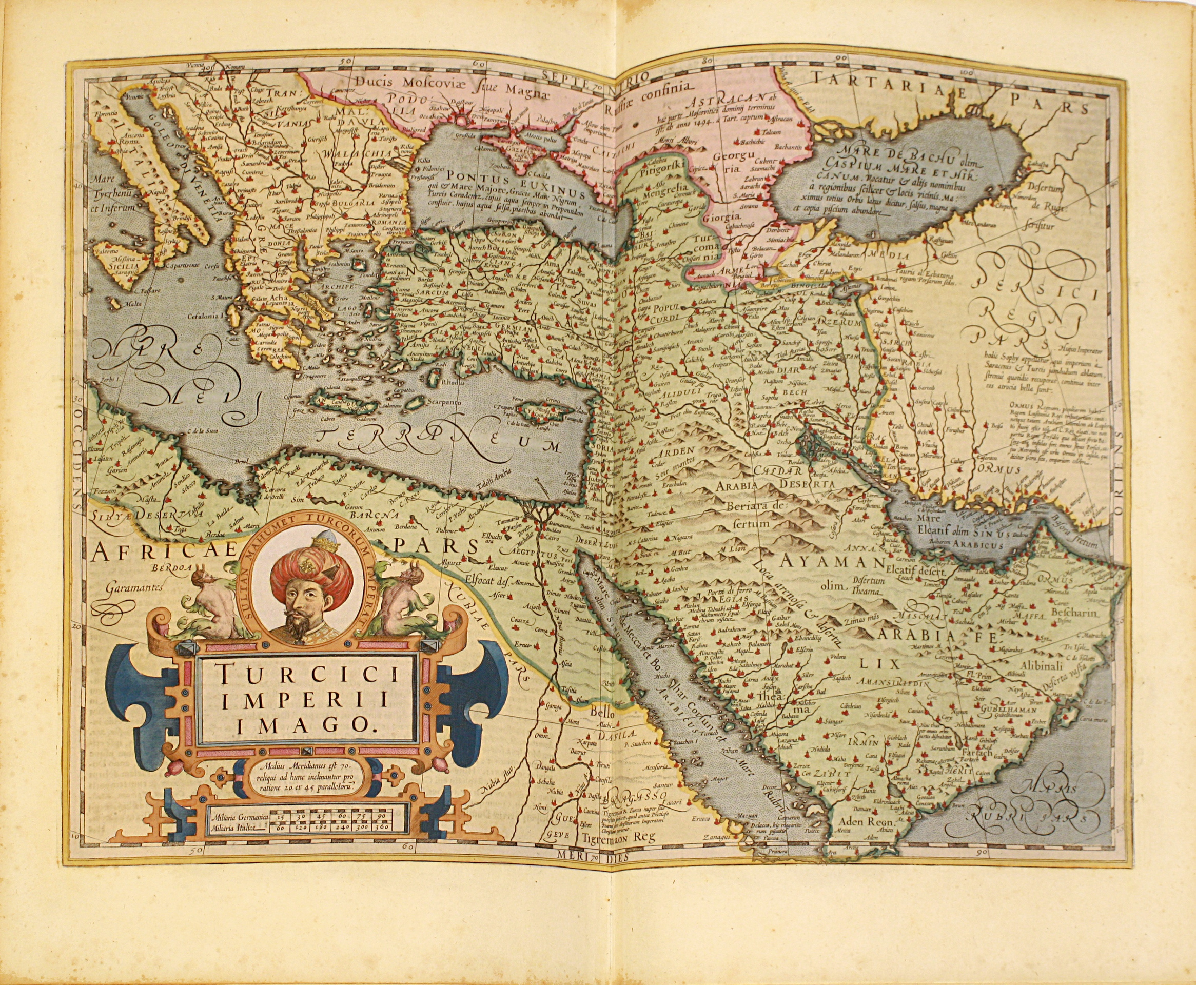
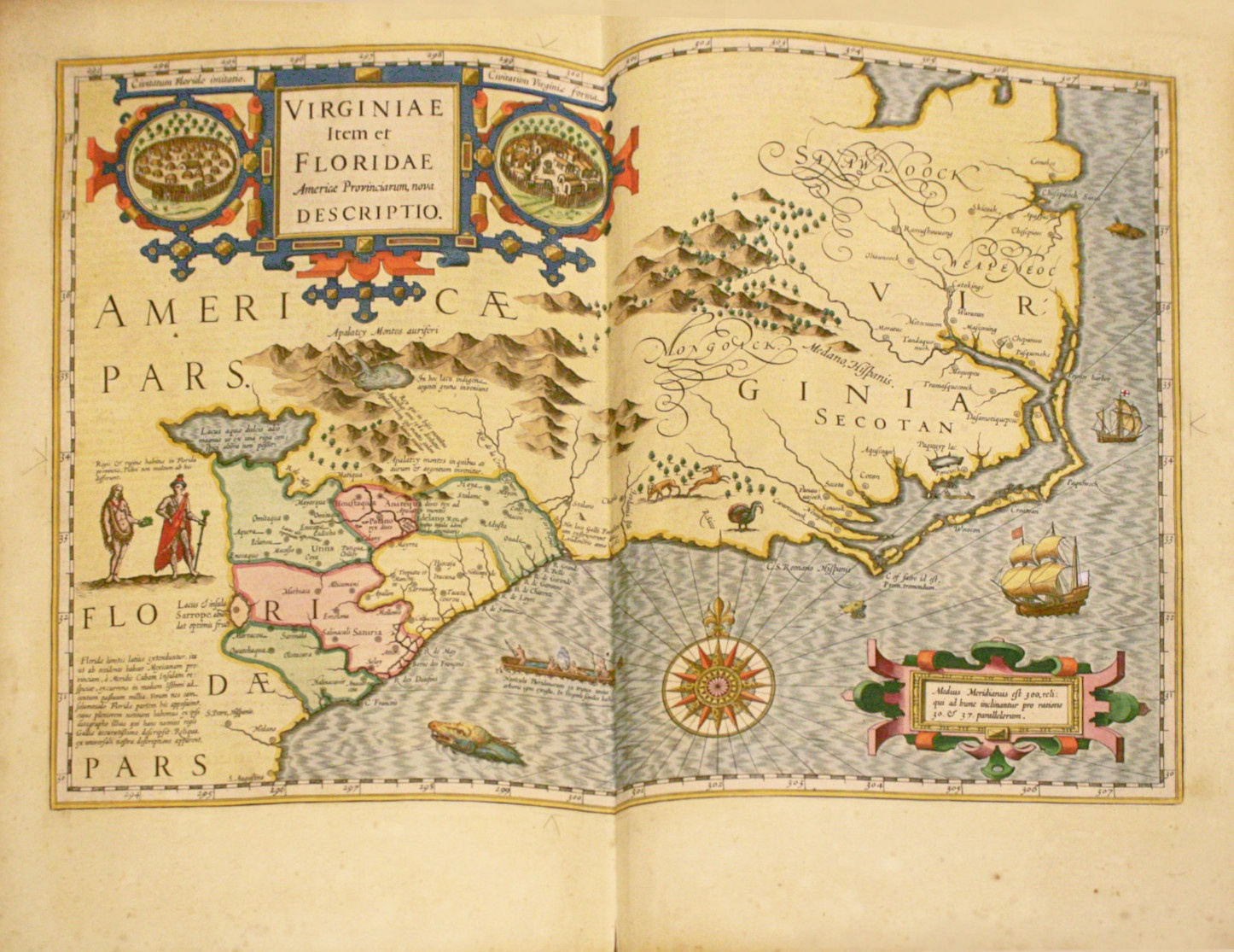
Superb atlas by Mercator printed in Amsterdam in 1623 composed of an engraved title, a double-page plate representing Mercator and Hondius at their work table, of four engraved titles and 156 engraved maps, all of them contemporary watercoloured.
Brunet, III, 1644 ; Koeman Me 27 A ; Sabin 47882 ; Graesse, Trésor de livres rares, 494.
Besides it is here the very first true “atlas” – word chosen by Gérard Mercator himself to refer to a collection of maps, and which will only be adopted later by all geographers.
Fifth edition of this famous atlas, “more complete than the four previous ones” (Brunet).
All the maps are on double-page except one (page 160).
“Gerardus Mercator (1512-1594) especially applied himself to philosophy and mathematics and this with so much zeal, that he often spent days without eating and nights without sleeping in order to give all his time to the study. He also dedicated himself to engraving that he learnt in Gemma Frison’s workshop. Recommended in 1541 to Charles V by cardinal de Granvelle to which he had presented a terrestrial globe executed with a characteristic care, he made for this prince two other globes, superior to anything that had been made but that were destroyed during a fire. Towards 1559, Mercator settled in Duisbourg; little time later he was appointed cosmographer of the duke of Clèves. Towards the end of his life, he dedicated himself to theology, and published about the Scripture a few works that were banned.
Mercator allowed great progresses to geography that him and his friend Ortelius freed from Ptolemy’s yoke. Of a soft and ingenuous character, Mercator delayed the publication of his maps until Ortelius’ last copies, published little time earlier, were sold out : until Guillaume de l’Isle and Danville’s works, Mercator’ and Ortelius’s maps remained the most accurate.
We also owe him a notable improvement in the construction of navy maps. Mercator offered to represent the parallels and the meridians by straight lines cutting across one another in right angle.”
Mercator, the greatest name of 16th century cartography, is also considered as the greatest cartographer of all times with Ptolemy.
His friend, Abraham Ortelius described Mercator as being the “contemporary Ptolemy”.
In the end, Mercator did not live long enough to see his work finished and printed and it is his son Rumold who took charge of the publication.
“Contrary to the maps in Abraham Ortelius’s Theatrum orbis terrarium, Antwerp 1570, Mercator’s maps are original. Abraham Ortelius did what most of the atlas-makers of our time are engaged in: the reduction and generalisation of already existing maps. Gerard Mercator, with his sense of scientific word (which should be original and new) checked the current knowledge of the configuration of the earth’s topography against its fundamental sources and drew new maps in his original conception. This method of map-making took more time than it would have by mere copying. But he had not the intention to compete with Ortelius’s best-selling atlas”. Koeman.
A precious wide-margined copy, illustrated with 162 engravings, most of them on double-page, entirely contemporary watercoloured.
“A copy with colored maps 108 fr. de Sacy” mentions Brunet, a considerable price for the time.