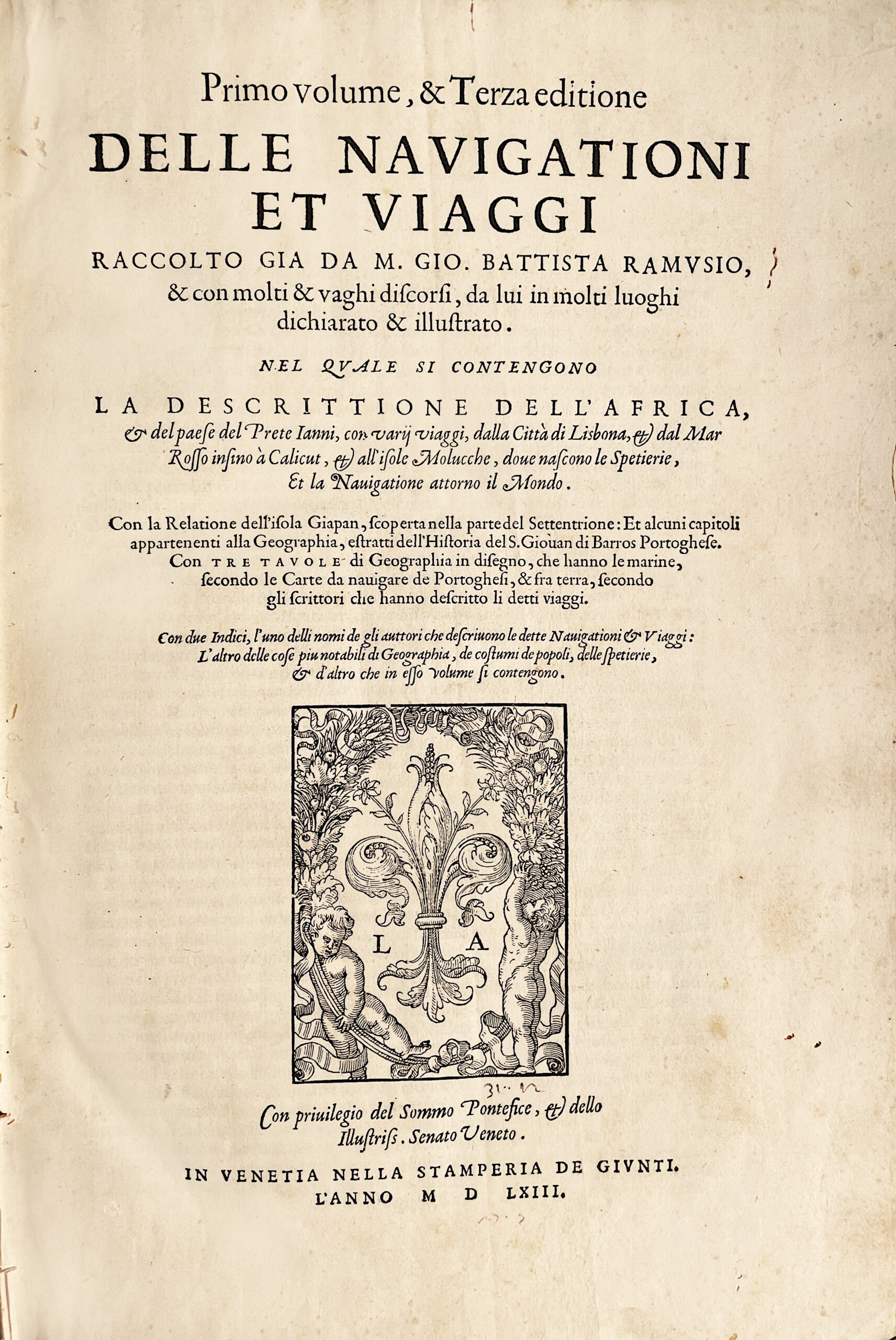
Venetia, Stamperia de Giunti. 1563, 1559, (1558 au colophon) & 1606.
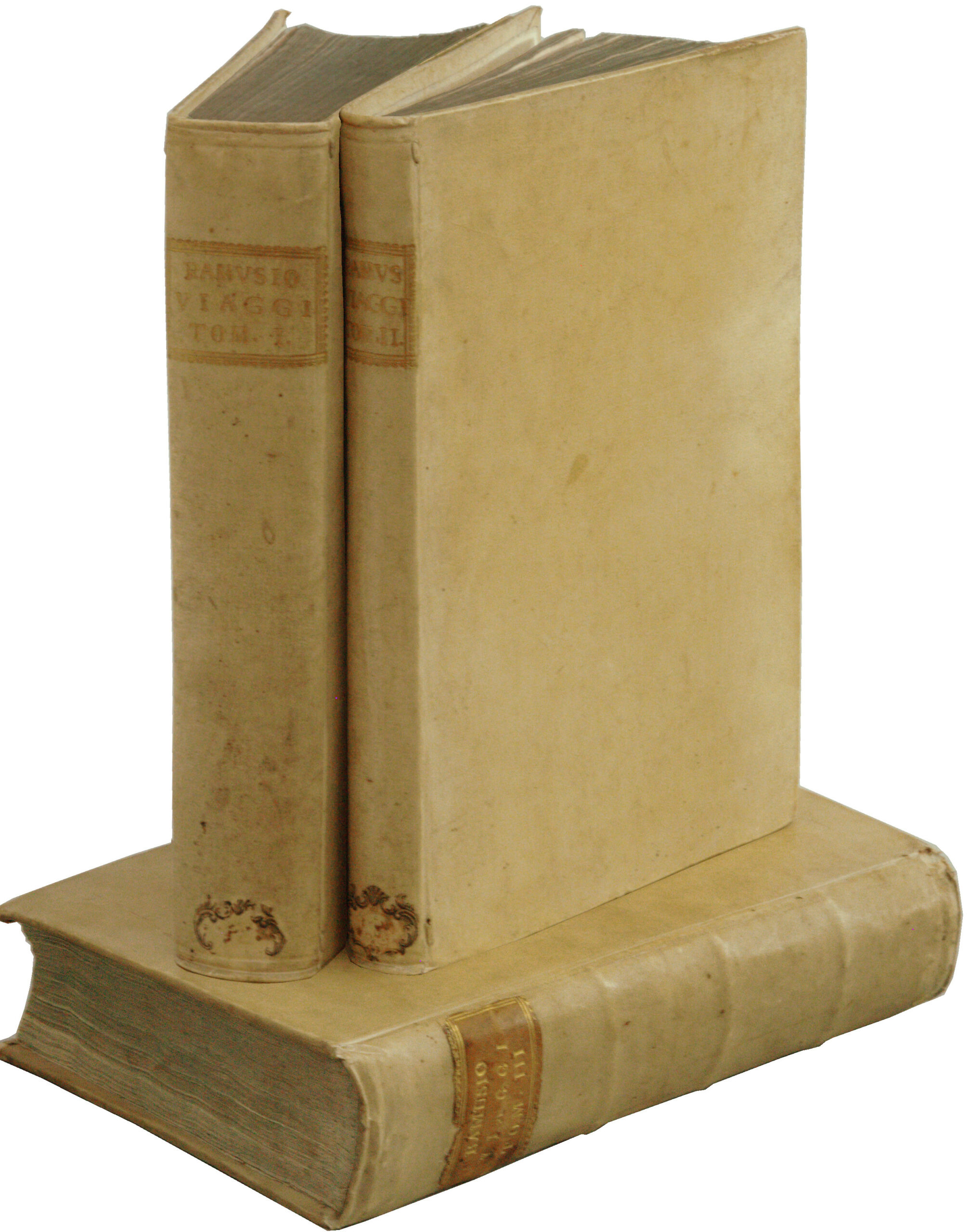
3 folio volumes lettering piece on the spine, [4], 34 ll, 3 double-page maps, (num. 394); [2], 28 ll, 156 ll; [6], 36 ll, 430 ll, 7 double-page maps [396]; leaves 108 and 109 of volume 1 calligraphed in the eighteenth century replace the missing original leaves. Full ivory vellum, ribbed spines, lettering-piece with gilt letters, blued edges. Early binding circa 1740.
335 x 223 mm.
First edition of volume II, third enlarged edition of volumes I and III, rare in uniform binding. Ramusio’s Voyages are always or almost always composed of volumes of different editions.
Thus, the copy offered in catalog 180 of one of the leading international bookshops published on June 18, 2019 at a price of $95,000 was described as follows:
« First editions of volumes II and II, third edition of volume I.
Folio. Three volumes. 3 folding plates in volume I, 7 double-page maps in vol. III, numerous woodcut illustrations, maps, and plans. Vol. I title and last leaf stained and repaired, e5-6 supplied ; Volume II quire H supplied. Early blind-paneled calf, minor restoration, early manuscript paper label at foot of spine. Some browning, staining, and spotting, some dampstaining, minor worning. Lower portion of Western Hemisphere map trimmed and supplied in manuscript. An especially handsome and fresh set. »
“A precious collection that deserves to be highly sought after by travel collectors” (Leclerc 484, for a copy from 1554-83-65).
Sabin 67731 for part I, 67737 for part II and 67740 for part III; Harrisse 304; Church 99.
This landmark work of sixteenth-century travel literature is with no doubt the most important collection of voyages and expeditions ever published.
It opened a new era in travel literature.
« This is one of the earliest and most important collections of voyages and travels, and may be said to have opened a new era in the literary history of voyages and navigation. This work… was the first great systematic collection that had so far appeared ». (Hill 1418).
« Ramusio, who truly earned the sobriquet of the Italian Hakluyt, was preeminent as an editor ; he handled his material with great skill and produced a collection of unique value. » (Penrose, Travel and Discovery in the Renaissance, 140-1620, p. 306).
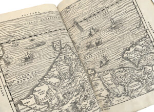
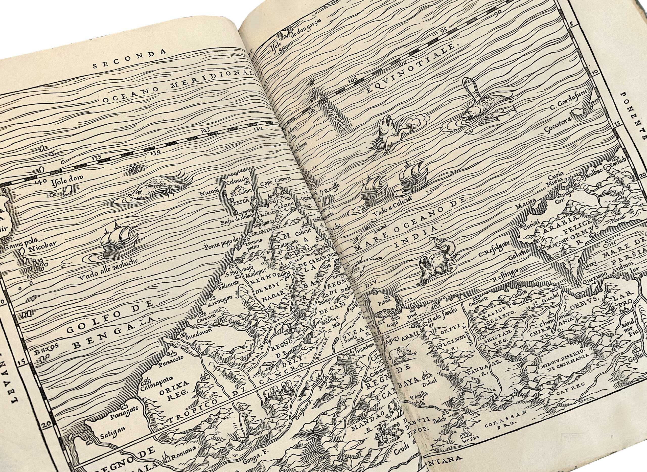
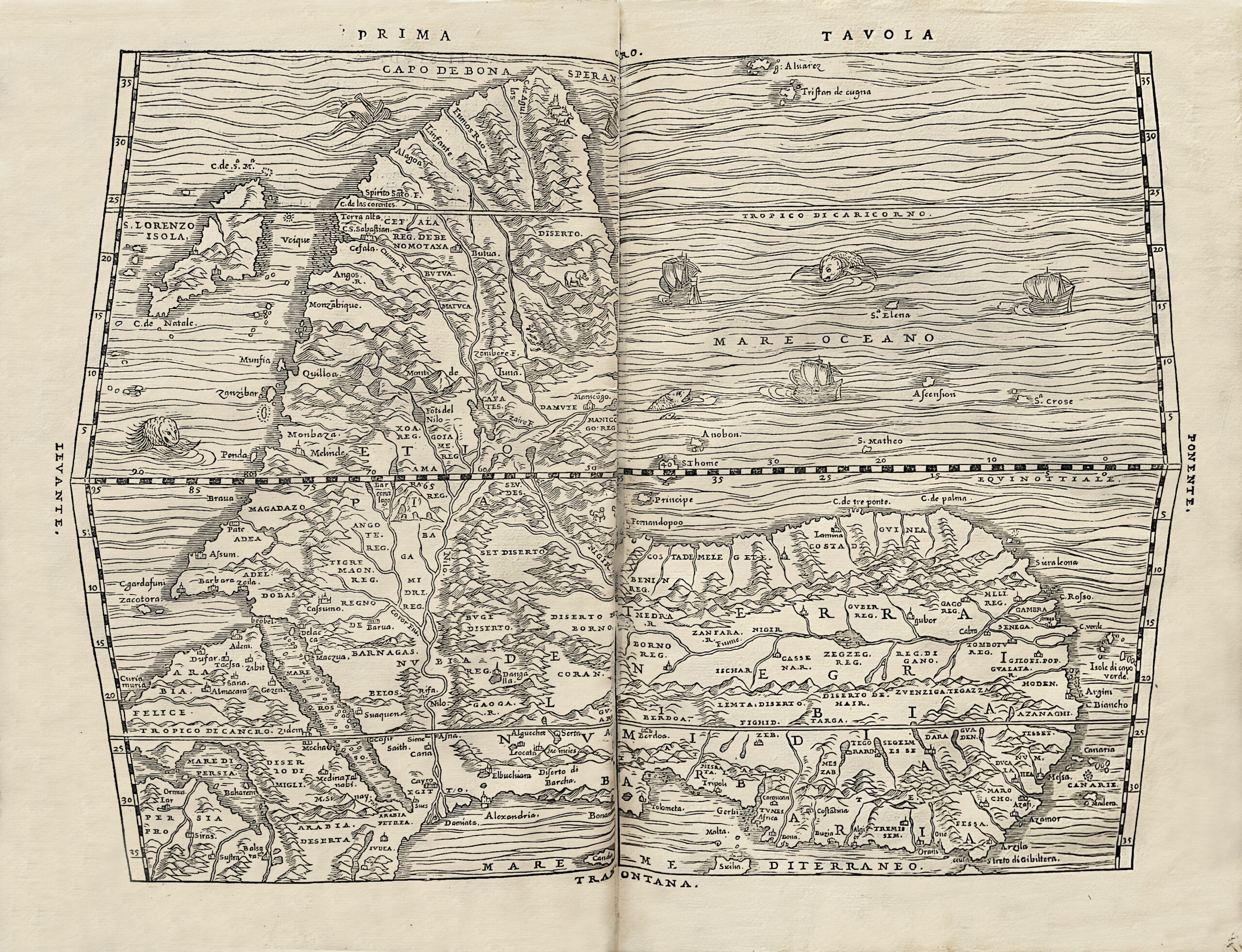
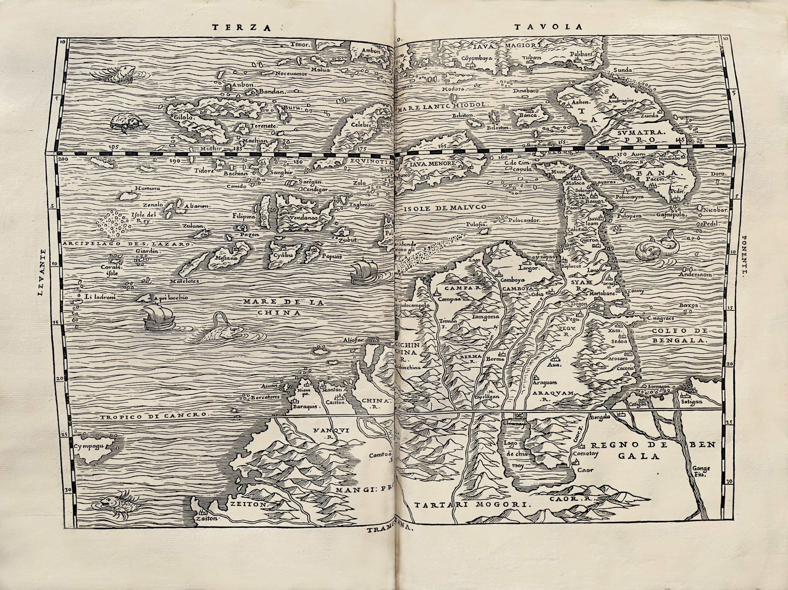
The first volume mainly deals with Africa and South Asia, the second explores Central Asia and Russia, while the entire 3rd volume is devoted to a detailed description of America, incorporating accounts by Peter Martyr; Oviedo, Cortes, Cabeza de Vaca, Guzman, Ulloa, Coronado, Fray Marcos di Niza, Xerez and Verrazano. The final part includes the first publication of Jacques Cartier’s discoveries in Canada.
The 10 superb double-page maps illustrating this collection represent America, New England, Canada, Brazil, Africa, Japan… and are of the utmost importance.
This classic in the history of exploration includes: the first printings of the description of present‑day New York by Verrazzano, the first European to see the harbor ; Cartier’s account of his pioneering inland exploration of the continent ; numerous maps and views of fundamental importance in the cartography of the New World ; and most important, the most complete and most influential text of Marco Polo’s book of his travels.
Ramusio (1485-1557), the great Venetian humanist, began corresponding with fellow humanist scholars, explorers, and travelers and travelers as early as 1525 in order to gather accounts of the Age of Exploration. In 1548 he began to assemble the work, which was first printed in 1550 (vol. I), 1556 (vol. III) and 1559 (the delayed Vol. II). Numerous revisions and reprints followed, and Ramusio spawned countless imitators and successors such as Hakluyt, Purchas, De Bry, and others.
John Locke declared that « Ramusio’s collection of voyages and travels [is] the most perfect work of that nature extant in any language whatsoever : containing all the discoveries to the east, west, north, and south ; with full descriptions of all the countries discovered ; judiciously compiled, and free from that great mass of useless matter, which swells our English Hackluyt and Purchas ; much more complete and full than the Latin de Brye, and in fine, the noblest work of this nature. »
« The publication of Ramusio may be said to open an era in the literary history of Voyages and Navigation. Instead of accounts carelessly copied and translated from previous collections, perpetuating errors and anachronisms, we find in this valuable work, original narratives which betray the hand of a scholar of great critical acumen. Nor should we forger that we are indebted to Ramusio for the preservation of accounts of voyages of the utmost importance to the student of American history ; and did his work contain only the « Relatione d’un gentilhuomo del Sig. Fernando Cortese, » and the first voyage of Jacques Cartier to Canada, the two capital relations would entitle the Raccolta to a prominent place in any American library » (Harrisse, Bibliotheca Americana Vetustissima).
The maps were attributed to the great Italian cartographer Giacomo Gastaldi, the tutor of Ramusio’s children. Burden 34: Universale della parte del mondo movamente ritrovata : « This is the first American map to include any of the names from the travels of Francisco Vasquez de Coronado, the first European to travel extensively the south-western part of North America » ;
Burden 35 : La Nuova Francia : « the first map devoted to New England and New France, the latter name being used here for the first time » ;
Betz 4: « It is the first printed map of Africa in a book to show a southbound river ; the Zembere … [it] also shows for the first time on a printed map of the entire continent, the island of Madagascar ».
The work is also decorated with historiated initials and engravings in the text and on full pages showing the flora and fauna of the New World, as well as the customs of the Indians.
Borba de Moraes (II : 698-99) : « we are indebted to Ramusio for the preservation of accounts of… great importance to the history 0f Brazilian navigation ».
A precious wide-margined copy (height: 328 mm) preserved in its elegant 18th century uniform bindings with a Countal provenance: Francis de Astolphy and Comtesse de Clercy at the Château de Baromesnil near Eu.