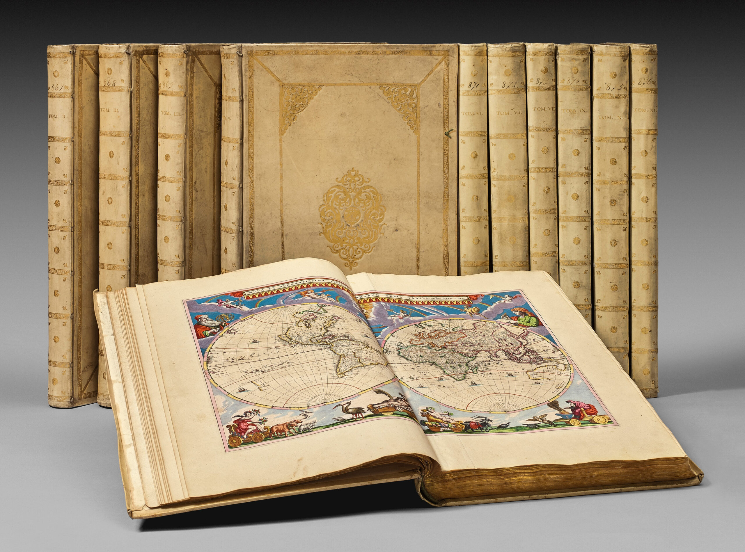
Amsterdam, Joannis Blaeu, 1662-1665.
11 large folio volumes [555 x 352 mm] bound in full overlapping vellum, double frame of gilt borders on the covers with central medallion of gilt globe, decorated flat spines, gilt edges. Contemporary binding.
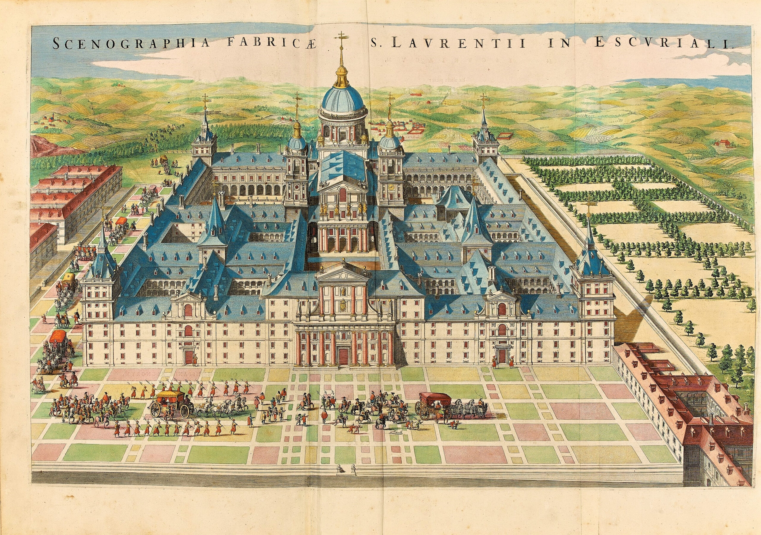
Complete with its 593 maps, views and plans, most of them on double-page, with its title-pages and engraved frontispieces illuminated with gold : a map of the world, 70 maps for Northern Europe, 18 maps for Russia and Poland, 11 maps for Greece and Eastern Europe, 96 maps for Germany, 63 maps for Belgium and the Netherlands, 113 maps for the British Islands, 64 maps for France, 6 maps for Switzerland, 59 maps for Italy, 28 maps for Spain, 13 maps for Africa, 28 maps for Asia and finally 23 maps for America.
First edition (second issue for the 1st volume) of Blaeu’s famous and sumptuous Maior Atlas, generally qualified as the “greatest and finest atlas ever published. This qualification is mainly due to the extremely high typographic standard. But apart from the typographic aspect, secondary qualifications such as binding and colouring have greatly added to the fame of the Atlas Maior” (Koeman I, p. 201).
Jean Blaeu was born in Amsterdam in 1596. His father, Willem Janszoon published his first cartographic work in 1599 and his first Atlas in 1630.
In 1638, Jean succeeded to his father at the hydrographic work and his efforts reached its peak through the magnificent Maior Atlas “unsurpassed in history and in modern times, which gave eternal fame to the name of the Blaeus”. Koeman.
A superb copy absolutely complete with its 593 maps, views and plans, most of them on double-page, with its title-pages and engraved frontispieces illuminated with gold: a map of the world, 70 maps for Northern Europe, 18 maps for Russia and Poland, 11 maps for Greece and Eastern Europe, 96 maps for Germany, 63 maps for Belgium and the Netherlands, 113 maps for the British Islands, 64 maps for France, 6 maps for Switzerland, 59 maps for Italy, 28 maps for Spain, 13 maps for Africa, 28 maps for Asia and finally 23 maps for America.
This extraordinary atlas was and remains the most ambitious, the vastest and the finest editorial project of topography, cartography and hydrography ever realized.
A magnificent copy of great freshness, admirably colored and contemporary illuminated, of the most beautiful atlas made by the Western printing industry.
The quality of its coloring, its bindings and its purity make of this copy one of the most beautiful ever seen on the market.
“An owner of an atlas who required a particularly decorative embellishment would commission an artist to illuminate the atlas with gold and paint using the finest materials available. One of the most famous of these artists was Dirck Jansz. van Santen” (Koeman).
The editor Blaeu had his atlases bound upon his customers’ requests, especially by the binder of Amsterdam Albertus Magnus for the finest ones.
The last copy to appear on the market, not as brilliant, was sold for 824 000 € on the 17th of November 2015 (Sotheby’s London, lot 46).
See less information