Dijon, P. Palliot, 1643.
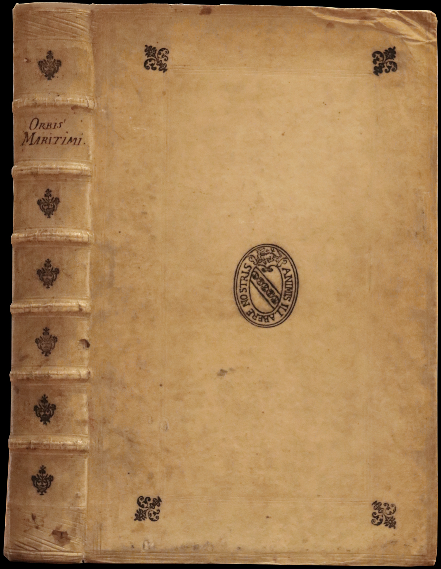
Folio [358 x 220 mm] of (13) ll. including 1 engraved frontispiece, 725 pp., (19) pp. including 1 full-page plate, 43 engravings in the text, 1 folding plate out of pagination. A marginal tear on pp. 105 and 465 without loss, lower corner of p. 505 torn up not affecting the text, small wormtrack in the margin of pp. 247 to 270, some light marginal foxing, outer margin of the first 3 ll. slightly trimmed, small burnhole in the frontispiece. Stiff vellum, blind-stamped double fillets around the covers, blind-stamped fleurons at the corners, blind-stamped medallion in the centre with the motto Animis Illabere Nostris, spine ribbed and decorated with blind-stamped fleurons, red mottled edges. Contemporary binding.
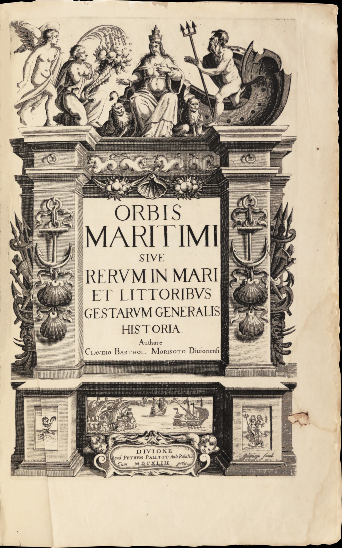
First and unique edition of the first encyclopedia dedicated to the maritime world.
Sabin 50723; Borba de Moraes 598.
The present copy belongs to the first issue with the dedication to King Louis XIII dated January 1643.
“A kind of encyclopedia of everything relating to maritime affairs. Pages 592-612 contain a description of America, with three maps. The cuts are copied from De Bry.” (Sabin).
“ Claude-Barthélémy Morisot was born in Dijon in 1592, and died there in 1661.
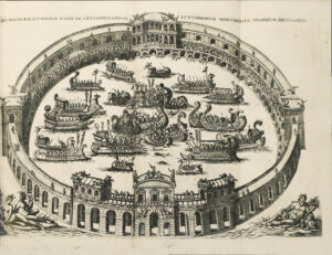
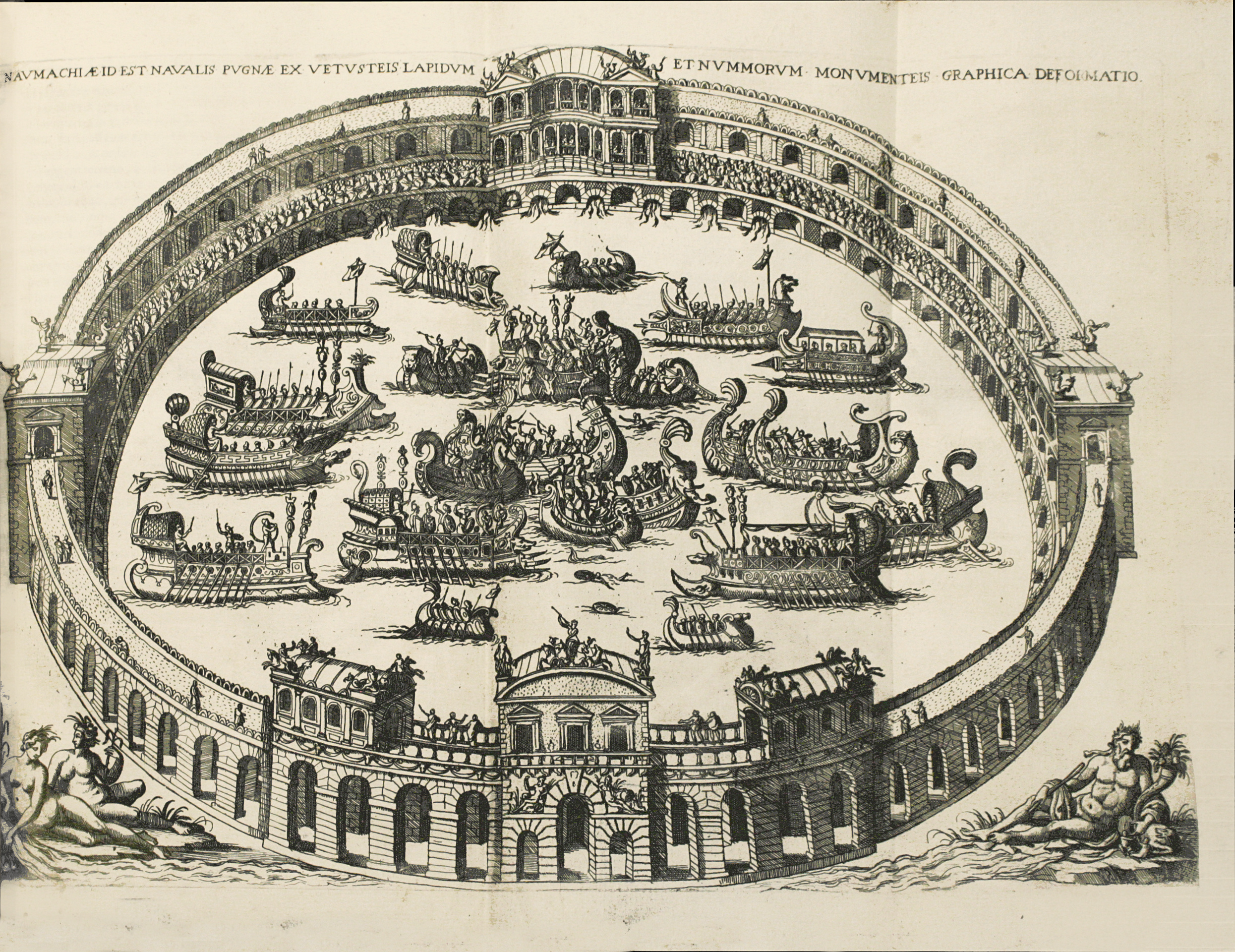
His ‘Orbis Maritimus’ is a folio of X ll., 725 pp., IX ll., engraved title and printed maps in the text; between pages 200-201,there is a large folding plate showing ancient naumachies; pages 578-609 are specially dedicated to the two America’s.” (Brunet, Supp., 1122).
With engraved title-page, 1 full-page plate, 1 double-page engraved plate, 23 half-page engraved maps, 20 half-page engraved illustrations.
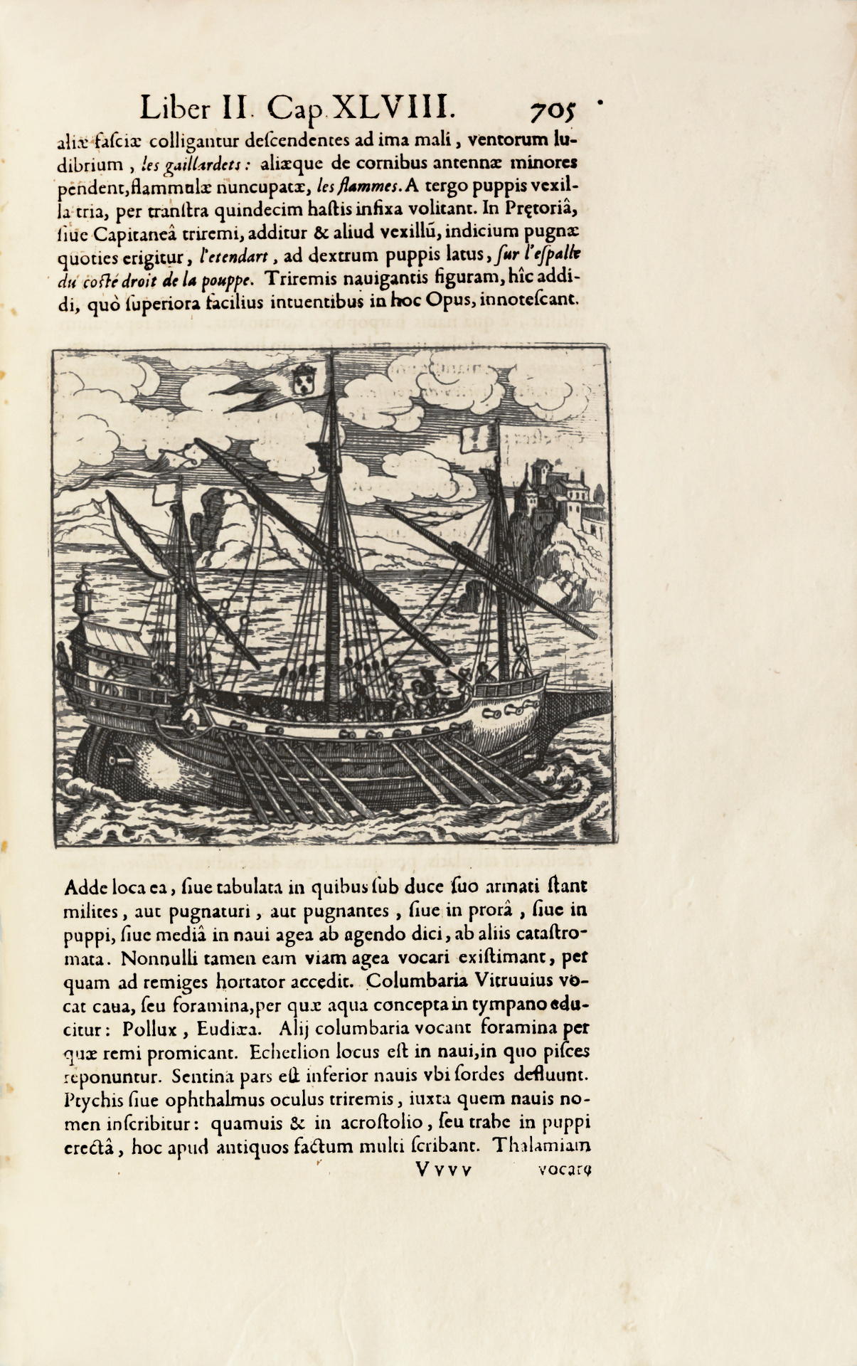
“Has among other merits that of being the first naval history. It is divided into two parts. The first is devoted to ancient times and the second is concerned with modern times, and the deeds of the British, French, Dutch, Spanish and Portuguese. South America and Brazil are described on pp. 601 and following (the description of both Americas covers pp. 592-612 with 3 maps). The work is sumptuously printed… The plates showing different kinds of sailing crafts are very quaint. The map of Brazil is most curious” (Borba de Moraes).
The first part covers ancient times (to the great discoveries of the Renaissance), emphasizing the many naval battles, but also presenting the development of navigation and geography. The second part covers recent voyages of discovery and topographical description, drawing on numerous naval and maritime sources, including travel journals by European explorers.
A very good copy, with generous margins, preserved in its contemporary vellum binding.
See less information