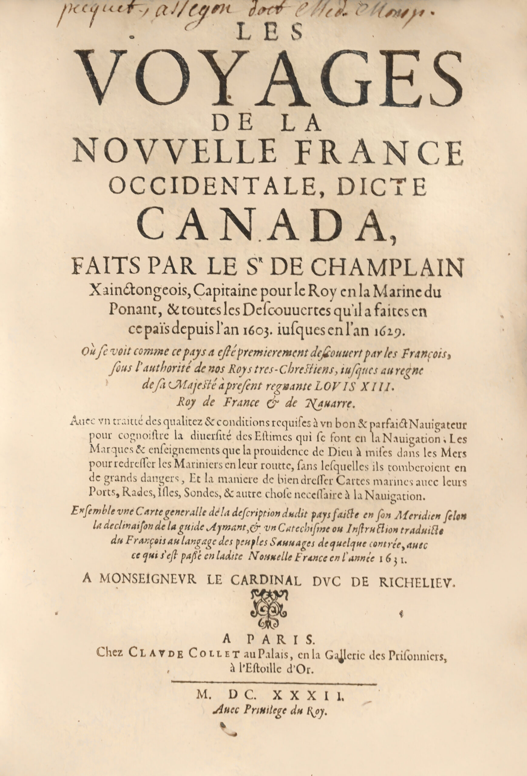
In Paris. At Claude Collet’s in the Palais, in the Prisoners’ Gallery, at the Golden Star. 1632. With the King’s Privilege.
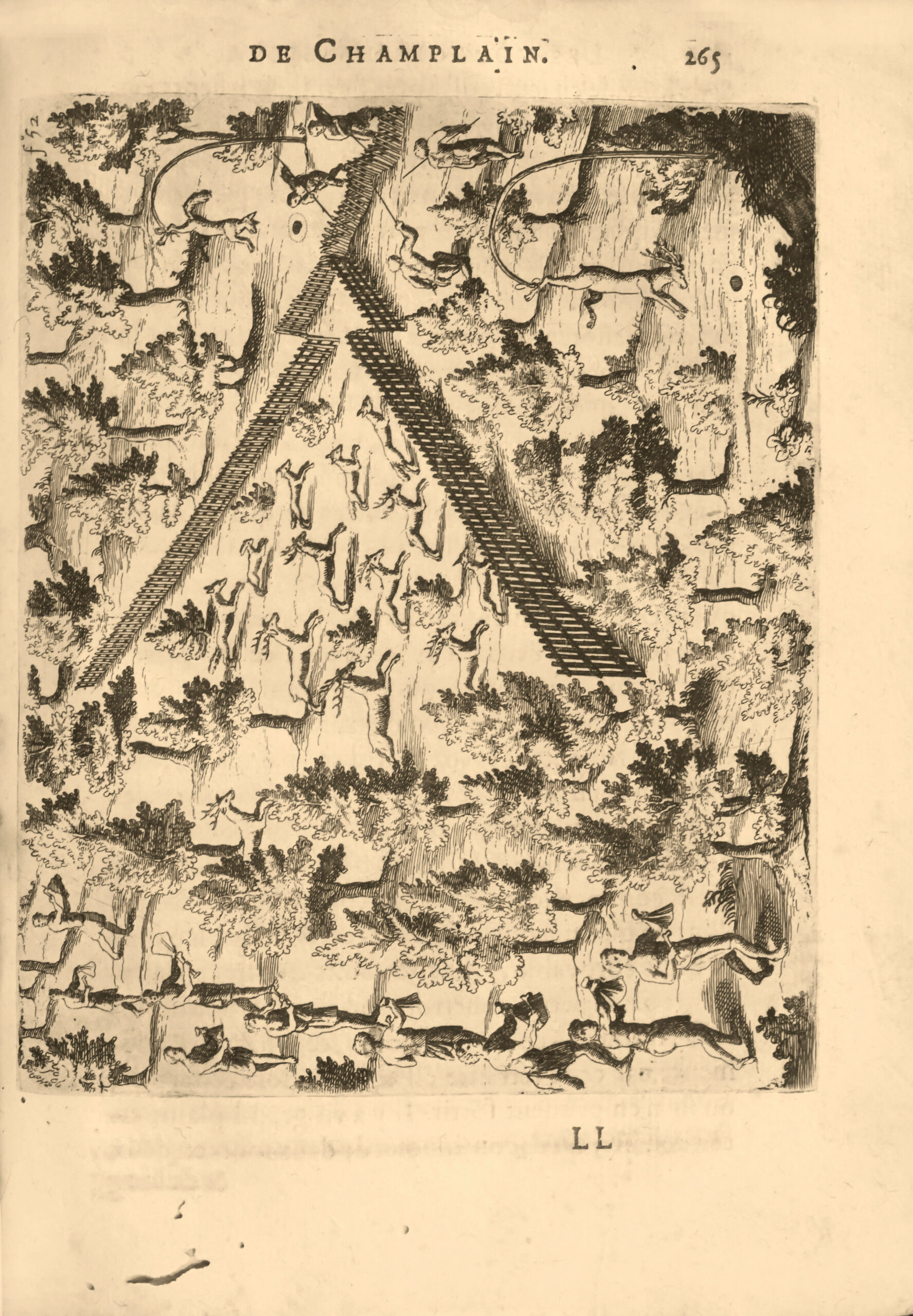
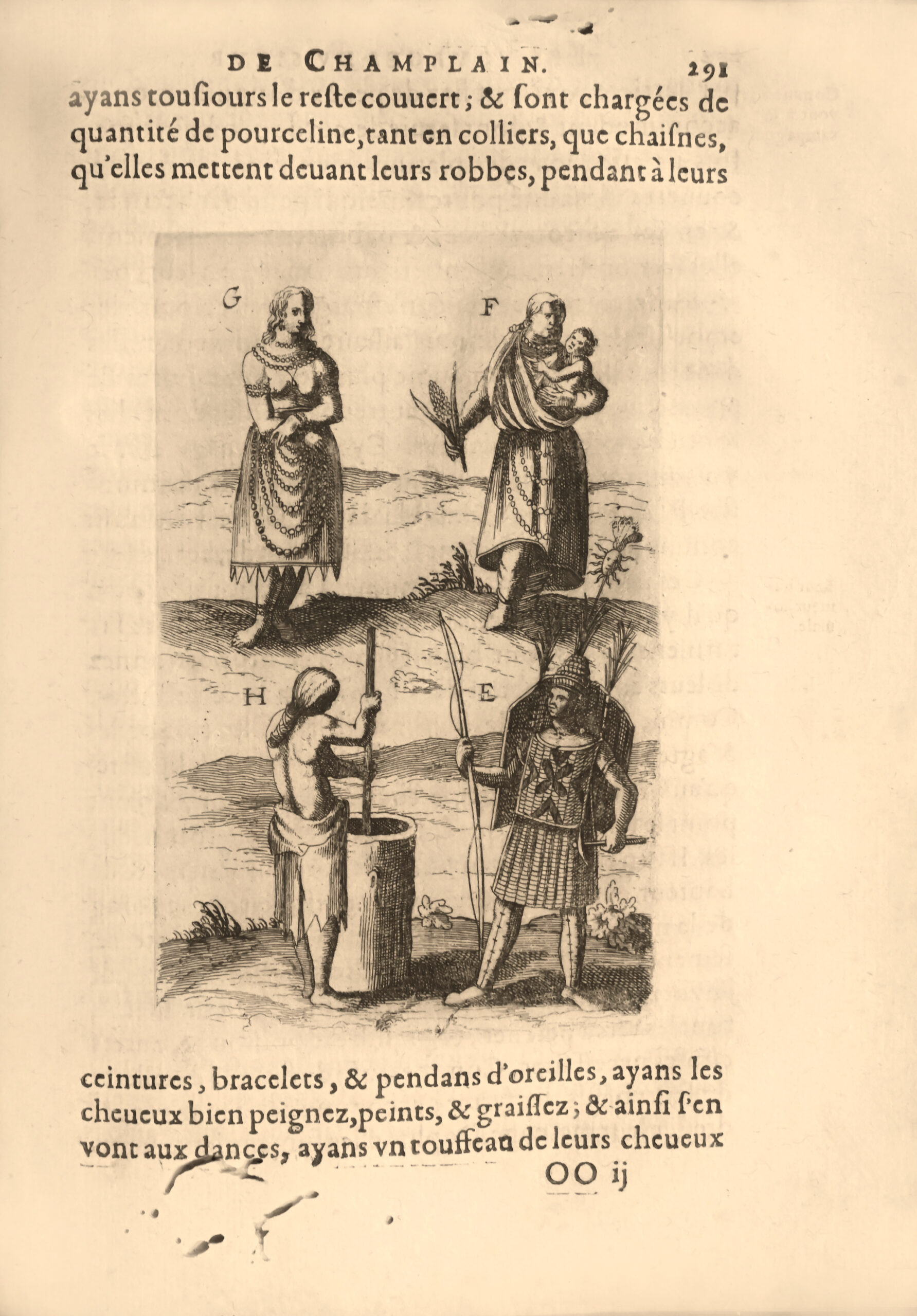
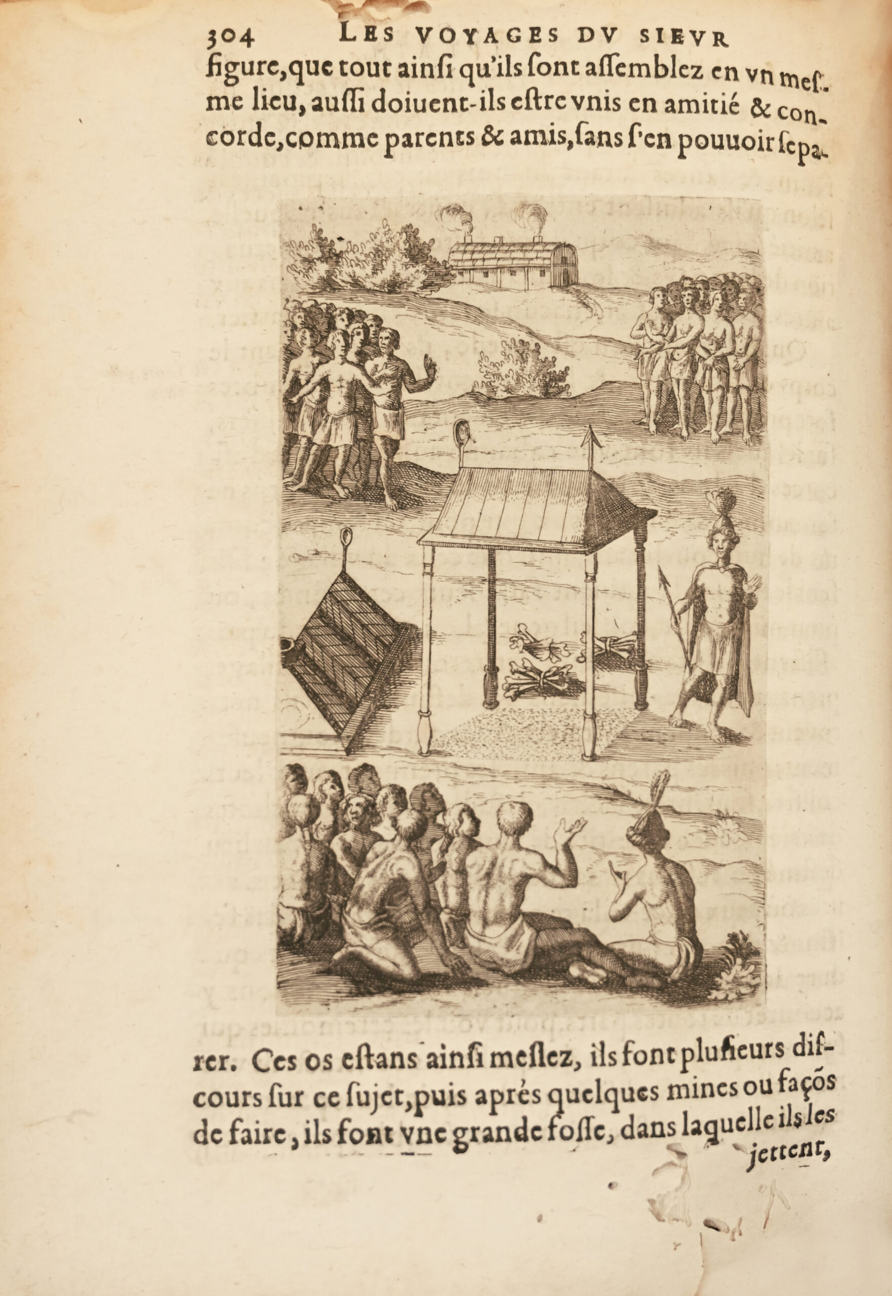
4to, pp. 16, (1) blank leaf, 308 pp., engravings in the text pp. 245, 291, 299, and 304, full-page engravings pp. 259 and 265.
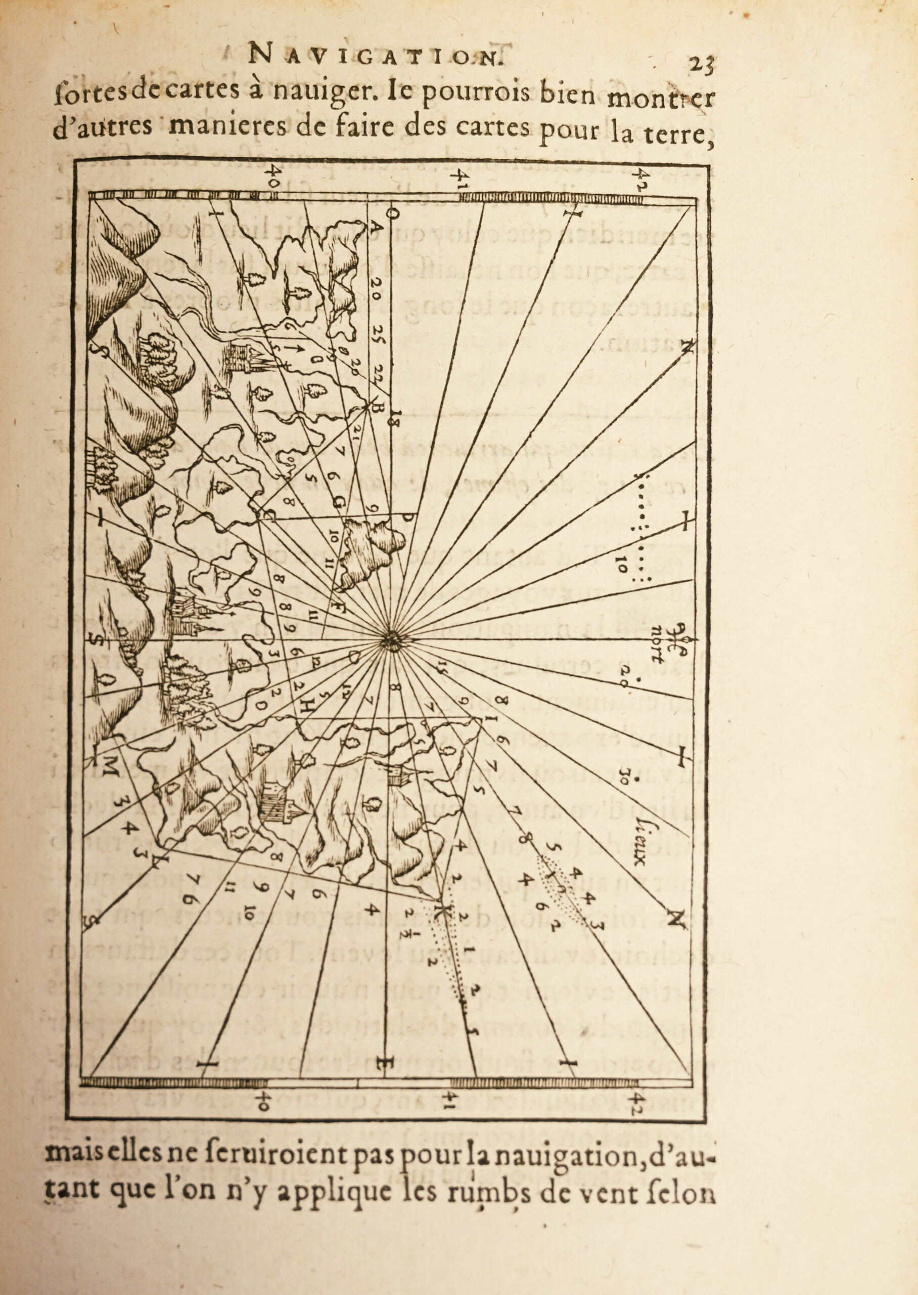
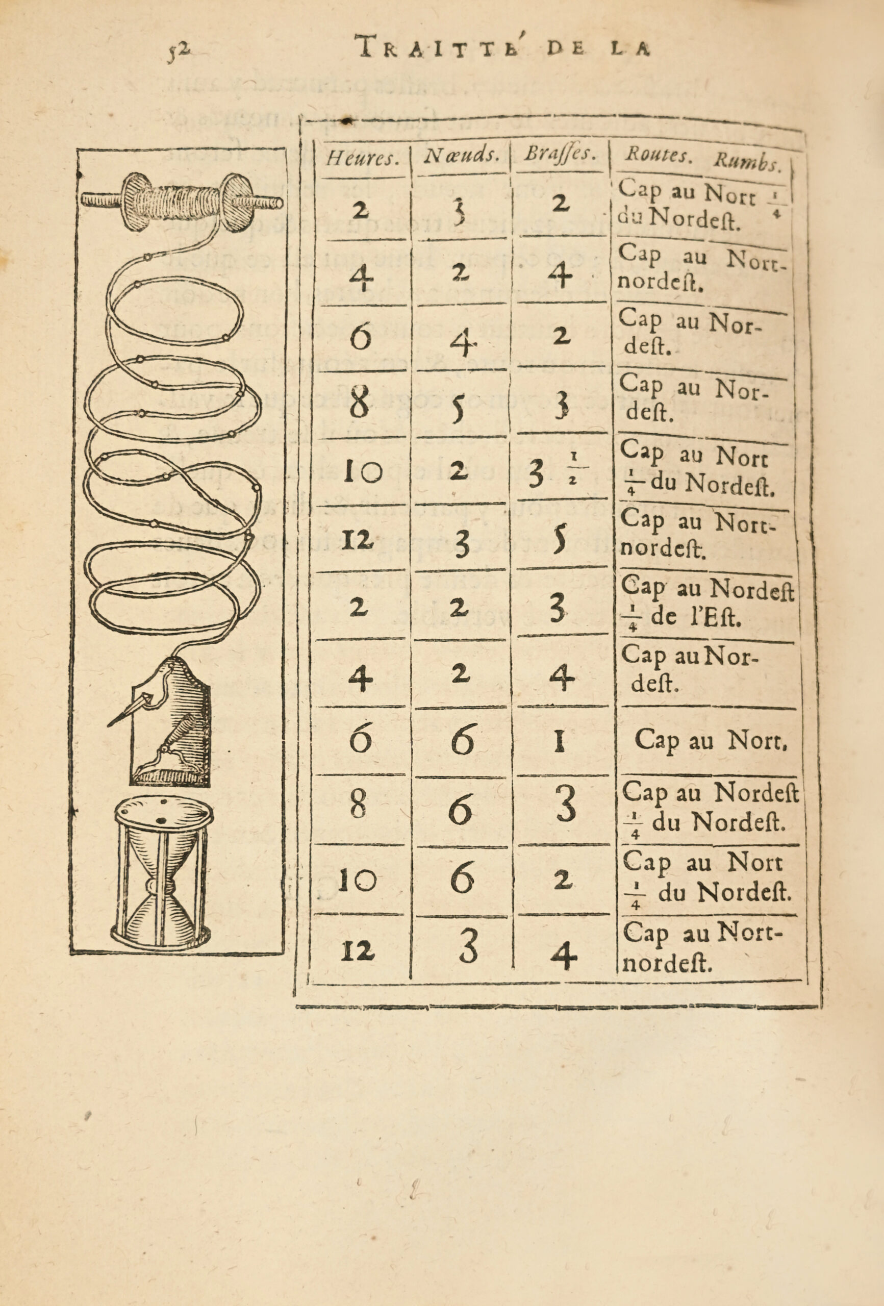
Second Part: 310 pp., (1) blank leaf, Christian Doctrine 20 pp., Treatise on the Navy and the Good Mariner by Sieur de Champlain, 54 pp., 1 map p. 23, Table, 8 pp.
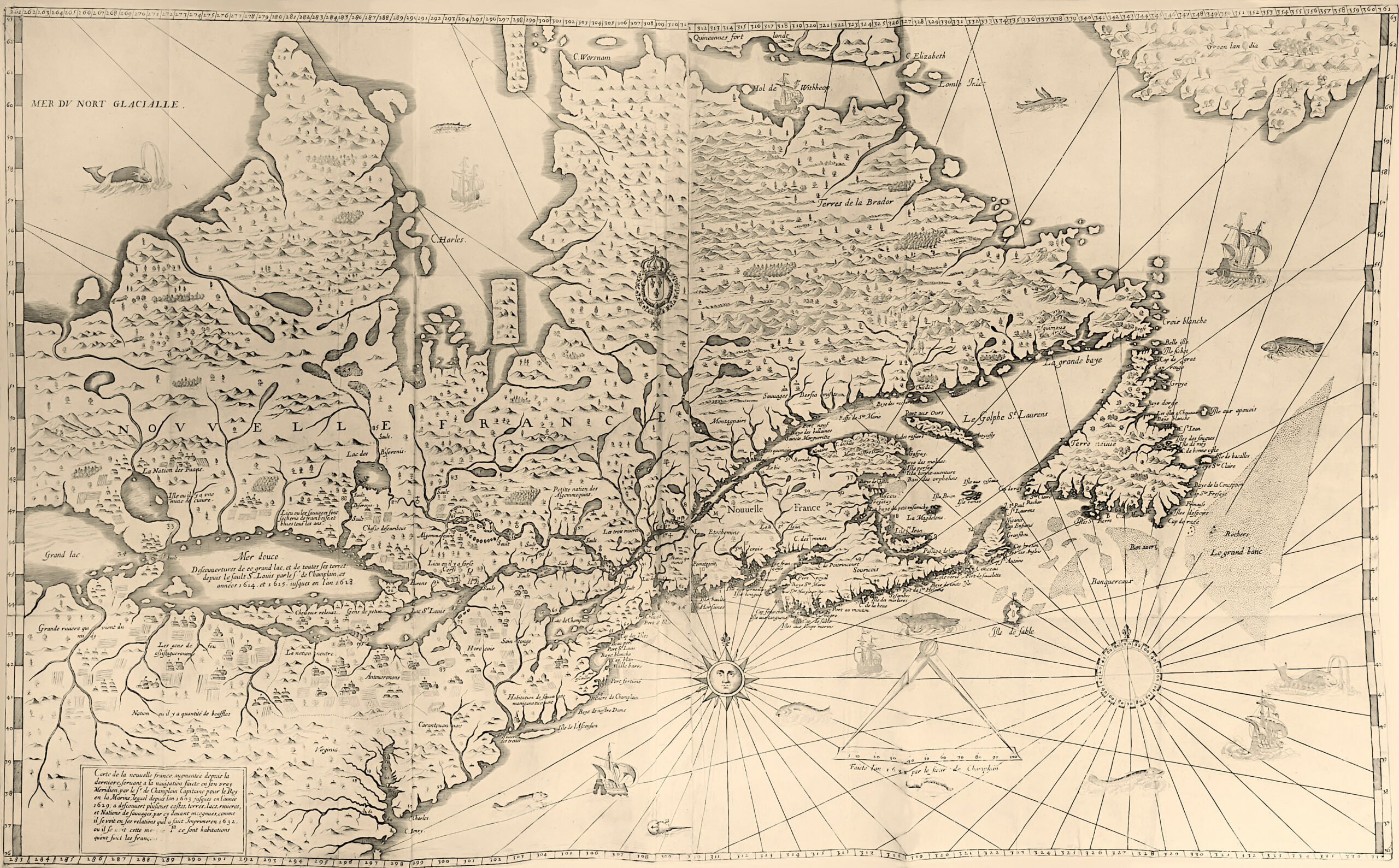
Map, New France, 1632, 2 sheets, 520 x 860 mm.
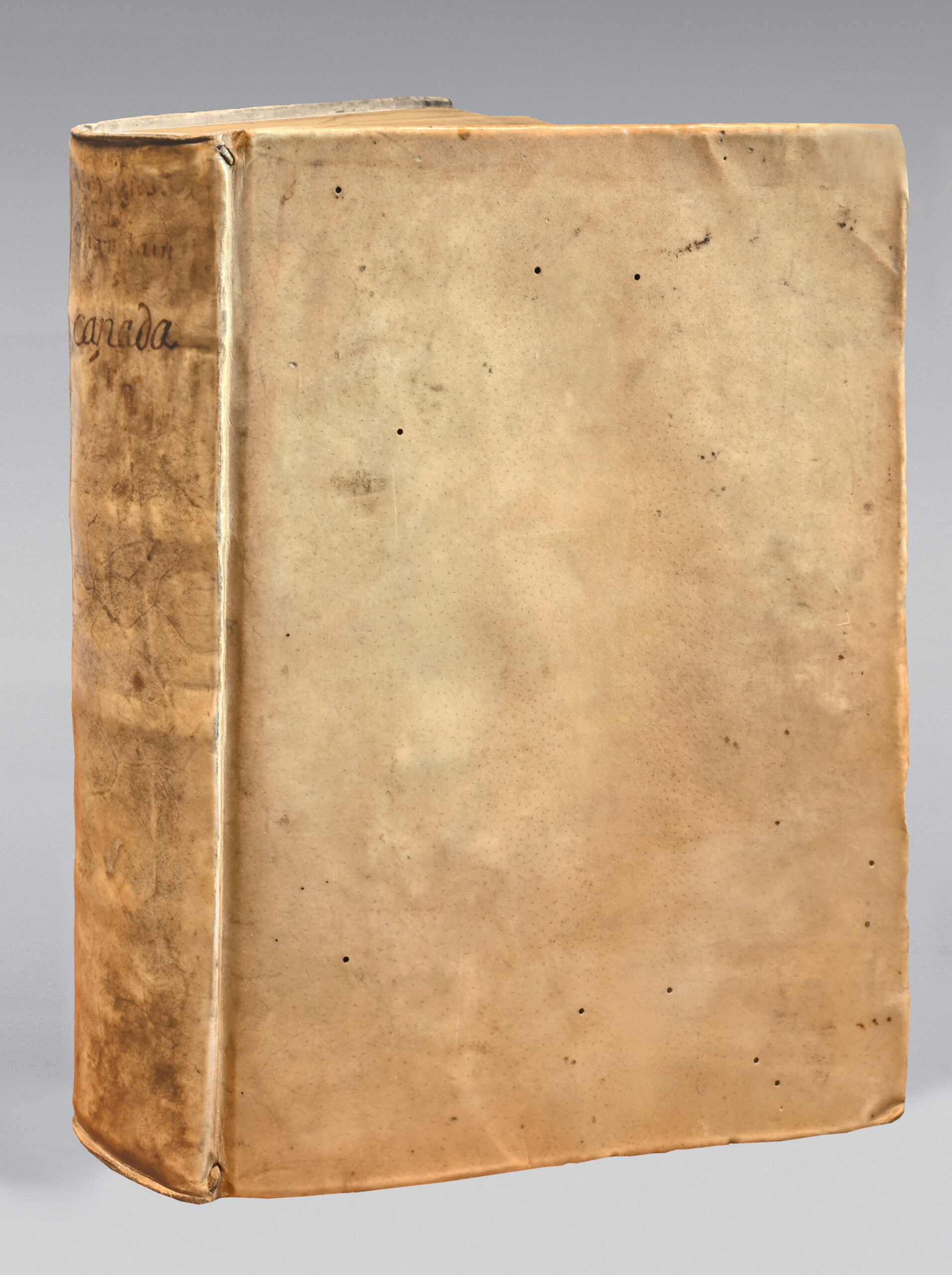
Full ivory vellum, smooth spine, marbled edges. Contemporary binding.
224 x 163 mm.
“The best edition.”The complete copy, on contemporary vellum, of Fouquet’s protégé.
« An exceedingly rare and sought-after edition. Of all the editions of Champlain’s book, this is the most complete.” (Leclerc, Bibliotheca Americana).
“The most complete and very rare edition of Champlain.” (Chadenat).
The different old editions are sought after and on January 17, 2024, Christie’s New York auctioned the 1613 edition of Champlain’s Voyages for $1,321,000.
“Of all the editions of Champlain, this is the only complete one…” (Church, Americana).
“It is perhaps the most important of the old editions, as it contains a collective narrative embodying a review of all preceding French expeditions to the New World, followed by and interwoven with Champlain’s own voyages to Canada: a short account of the First (1603), which had been published in 1604 and abridgment of the Second, Third, Fourth, Fifth, and Sixth (1608-1613), as they had been published in the volume dated 1613. These voyages end on p. 210. Pages 239-308 contain the Seventh Voyage (1615-1616), while the Eighth Voyage (1617) is only mentioned between pp. 211 and 214 as unimportant. The Second Part contains the Ninth Voyage and a History of Canada (1620-1631), pp. 1-310 , a Treatise on Navigation, pp. 1-54 ; followed by the Doctrine Chreftienne, du R. P. Ledesme and l’Oraison Dominicale par le R. P. Massé, with separate signature-marks and pagination. This was the last of Champlain’s works.” Church.
The edition, dedicated to Cardinal Richelieu, is adorned with 6 engravings in intaglio, including 4 in the text and 2 full-page, showing notably the attack on an Iroquois village, a deer hunt, a ritual, etc. and two wood engravings in the text, one of which represents an example of a navigation map.
Samuel de Champlain, founder of Quebec and governor of New France, was born around 1570 in Saintonge to a Protestant family. He served the party of Henri IV during the last wars of the League, conducting raids on the coasts of Brittany. After the peace of 1598, the commander of Chaste, governor of Dieppe, having obtained a commission from Henri IV to create new establishments in North America, associated Champlain with this great endeavor.
Champlain embarked at Honfleur and anchored on May 24, 1603, at the harbor of Tadouzac, located in the Saint Lawrence. There he left his ship and went up the river with a small boat to the Saint-Louis rapids where Jacques Cartier had stopped on his last voyage; then he penetrated into the interior lands and drew the map which he brought back to France with a detailed report of his voyage.
Champlain returned to the New World and stayed for 3 years. He conducted numerous explorations along the coasts and in the interior lands, all documented in these voyages.
Back in France in 1607, Champlain stayed only six months before departing for a third voyage, with the titles of geographer and captain for the king or the navy. This third expedition was the most important. Ascending the Saint Lawrence with the intention of forming a permanent settlement in Canada, he chose a location about 130 leagues from the mouth of the river where its banks suddenly narrow. In 1608 he laid the foundations of the city of Quebec, which means “strait.” The following year, Champlain conducted several explorations on the Saint Lawrence, supported the Algonquins against the Iroquois, and after securing victory for his allies, gave his name to the lake by which the battle was fought; then he descended the river that connects this lake with the Saint Lawrence, which he named Richelieu. He then returned to Quebec, and from there, to France.
Back in Canada in 1610, he again defeated the Iroquois. Inspired by the discovery of the Englishman Hudson, he wanted to search through northern America for a route to China. His first expedition to the Ottawa River was fruitless, and soon he had to return to France to recruit men for his colony. He brought back with him in 1615 religious of the Recollet order, who assisted him in his mission by spreading the Christian faith in New France. Then, revisiting his plan to discover a passage to the northwest, he once again ascended the Ottawa, and advancing, sometimes by canoe, sometimes by land, he reached Lake Huron, following its southern shores, then moved through the plains to Lake Ontario, which he crossed.
After assisting the Hurons against the Iroquois, he spent the winter among the Algonquin peoples, studying their customs and language. He left them in 1616, and returned to Europe the following year.
In 1620, he returned to Canada for the fifth time, with the title of lieutenant general of Marshal Montmorency, appointed vice-admiral of New France.
“After the Treaty of Saint-Germain-en-Laye (1630), France regained possession of Canada, and Champlain was sent there as governor in 1633. It is from this period that this country experienced its most significant growth; it is to Champlain’s courage, enlightened administration, and perseverance that France owed the stability of its establishments in the new colony. He quickly transformed the village of Quebec into a flourishing city, aided in this by the Indians, whose affection he had won, and over whom he exercised great influence. During the brief English domination, the natives had withdrawn, avoiding any communication with them; when peace returned the French, the Indians rushed to them eagerly and renewed their interrupted ties. Champlain died in Quebec, surrounded by the esteem and veneration of all. We owe to him a Treatise on Navigation, published in 1632, and the account of his Voyages, which include his navigations and discoveries from 1603 to 1629.” Pierre Larousse.
The importance of Champlain’s maps is evident from this analysis.
“This is a crucially important Americanum, with accounts of Champlain’s voyages to America between 1604 and 1613. The large two-sheet map, prepared in Paris in 1612, is absent in many of the extant copies; as Burden notes it is very rare. It exists in but a single state, and was never reissued. He notes ‘Although often lacking from the book, the map is the first to indicate a chain of Great Lakes, Lake Champlain and Montreal.’ Champlain’s efforts were crucial in establishing a French presence in the New World. Again Burden: ‘The work was part of the overall plan to gain as much support as possible for the fledgling colony. It is interesting to note that Champlain relies only on his own knowledge and that of the native Indians for his geography. Other European sources that he had not substantiated he depicted with honesty and care. Particularly noticeable are the northern shore of the Gulf of St. Lawrence and the Maritimes marked with the legend ‘The author has not yet recognized this coast. Montreal is shown just a year after Champlain set up a trading post there. However, it was not to be permanently occupied until 1642. The area further upriver is derived from Indian sources. Lake Ontario, depicted quite accurately, is marked Lake containing 15 crossings of the savages’ channels. At the western end of the lake is sault de au, the first reference on a printed map to Niagara Falls.
The other large map, the Geographic map of New France in its true meridian is almost as scarce as its larger companion, and is also singularly important. “The map related the numerous voyages of Champlain to 1611, and of the English further to the north. Most particularly recorded is the discovery by Henry Hudson of the bay named after him. It is noted on the map, with the legend noticeably in English, the bay where hudson did winter. In this map’s second state it also records Champlain’s voyage during 1613 some distance up the Ottawa River. This map has both latitude and longitude, “something virtually never attempted before on a North American map of such detail. Champlain’s acute awareness of the deviation of the compass enables him to portray the St. Lawrence River in its more correct south-west to north-east flow rather than the more usual west to east” (vide Burden). This is the second and most complete state of the map, i.e. with the course of the Ottawa, the sea monster at upper right and the 1613 date.
Following the Voyages are 3 other texts, namely:
- Christian Doctrine, by R. P. Ledesme of the Society of Jesus. Translated into Canadian Language, other than that of the Montagnais, for the Conversion of the inhabitants of the said country (10 pages) by the Jesuit missionary Saint Jean de Brébeuf (1593-1649). Includes in a second part The Lord’s Prayer, translated into the language of the Montagnais of Canada by the Jesuit missionary Ennemond Massé (1574-1646).
- Treatise on the Navy and of the Duty of a Good Sailor (54 pages) by Samuel Champlain. Original edition of this interesting treatise rich with the experience of the geographer.
- Table to recognize notable places on this map (8 pages).
Marginal wormholes in several leaves, with slight damage to the text. Foxing and some small stains.
The title bears a handwritten ex-libris in Latin: “pecquet, assegon doct. Med. Monsp (Montispessulani)” of the physician and anatomist Jean Pecquet (1622-1674), one of the pioneers of physiology. He completed his medical studies in Montpellier, thanks to the funding and protection of Nicolas Fouquet. Colbert appointed him as a member of the academy of sciences in 1666. The connection with the Assengon family appears with his niece Hélène Brocard, his only heir, who married Charles Assengon, physician to the Duchess of Montpensier.
Precious contemporary vellum copy of Jean Pecquet, protégé of Nicolas Fouquet, complete with the large and valuable map measuring 520 x 860 mm.
The copy Streeter in modern morocco and whose large map was entirely backed with cloth was sold for USD 264,000 on April 16, 2007, 18 years ago.